Overview
- The earliest evidence for maritime crossings dates to at least 65,000 years ago, when anatomically modern humans reached Australia via water crossings of up to 90 kilometres, and possibly much earlier if Homo erectus crossed the sea to reach Flores around 800,000 years ago — though the intentionality and technological basis of such early crossings remain hotly debated.
- Ancient civilizations developed remarkably diverse maritime technologies — Egyptian papyrus and plank-built vessels, Phoenician keeled merchantmen, Greek and Roman oared warships, Arab dhows exploiting monsoon winds, Chinese watertight-compartment junks, and Viking clinker-built longships — each adapted to the specific demands of their regional waters and trading networks.
- Polynesian wayfinding, which enabled the colonization of every habitable island across the vast Pacific Ocean using non-instrument navigation techniques including star compasses, ocean swells, and biological indicators, represents perhaps the most extraordinary feat of open-ocean seamanship in human history.
The ability to travel across water has been among the most consequential of all human technological achievements, enabling the colonization of continents, the establishment of trade networks spanning entire oceans, the projection of military power, and the transmission of ideas, organisms, and diseases between populations that would otherwise have remained isolated. The history of seafaring spans the entirety of the human experience with complex technology, from the earliest water crossings of the Pleistocene — which carried Homo erectus or its descendants to islands beyond the reach of land bridges — through the reed boats and plank-built vessels of the ancient Near East, the oared warships and merchantmen of the classical Mediterranean, the monsoon-riding dhows of the Indian Ocean, the watertight-compartment junks of China, and the double-hulled voyaging canoes of Polynesia.1, 2 Each of these maritime traditions represented an independent solution to the fundamental challenges of navigation, propulsion, and hull construction, and together they demonstrate that seafaring has been not a single invention but a recurring product of human ingenuity across diverse cultural and environmental contexts.1, 15
The earliest evidence for water crossings
The oldest evidence for maritime or at least water-crossing capability in the human lineage is indirect but striking. The Indonesian island of Flores, separated from the nearest landmass by deep-water straits that persisted even during Pleistocene glacial maxima when sea levels were at their lowest, has yielded stone tools dating to approximately 800,000 years ago, associated with Homo erectus or a related hominin species.3 If these dates and associations are correct, they imply that a pre-modern human species was capable of crossing at least several kilometres of open water in the Early Pleistocene, presumably using some form of raft or other simple watercraft. The nature and intentionality of such crossings remain deeply uncertain: they may have been deliberate, accidental (perhaps involving individuals clinging to floating vegetation during storms), or the result of tsunami transport, and the archaeological record preserves no direct evidence of watercraft from this period.3, 4
The colonization of Australia by anatomically modern humans, securely dated to at least 65,000 years ago and requiring water crossings of up to 90 kilometres even at glacial maximum sea levels, provides the first unambiguous evidence that humans possessed deliberate maritime capability.4 The crossing from the Sunda Shelf (the extended landmass of Southeast Asia during glacial periods) to the Sahul Shelf (the combined landmass of Australia and New Guinea) required passage through the "Wallacea" island chain, where inter-island distances of 30 to 90 kilometres demanded vessels capable of carrying sufficient people to establish viable founding populations on the far shore. James O'Connell and Jim Allen have estimated that a minimum founding population of perhaps 100 to 200 individuals would have been necessary to avoid the genetic and demographic risks of very small group size, implying multiple coordinated crossings or vessels capable of carrying substantial numbers of people.4
Beyond Australia, the colonization of the islands of Near Oceania — the Bismarck Archipelago and the Solomon Islands — by approximately 40,000 to 30,000 years ago required open-water crossings of over 100 kilometres, further demonstrating the maritime capabilities of Late Pleistocene human populations in the western Pacific.7, 4 In the Mediterranean, evidence for the exploitation of obsidian from the island of Melos by Mesolithic populations on the Greek mainland, dating to at least 11,000 years ago, demonstrates regular maritime activity in European waters by the early Holocene, and Cyprian Broodbank's work on early Cycladic maritime networks has documented the development of increasingly sophisticated island-hopping strategies in the Aegean from the Neolithic onward.16
Egyptian seafaring and the expeditions to Punt
Among the earliest well-documented maritime traditions is that of ancient Egypt. The Nile itself was Egypt's primary transportation artery, and riverine boat-building has a history in Egypt extending to at least the fourth millennium BCE, as evidenced by boat models, painted depictions on pottery, and the full-sized vessels discovered in pits adjacent to the Great Pyramid of Khufu at Giza, dating to approximately 2500 BCE.9, 2 The Khufu vessels, constructed from cedar planks joined by mortise-and-tenon joinery and lashed with rope, are among the oldest intact boats in the world and demonstrate a sophisticated understanding of hull construction, though their function — whether practical riverine vessels, ceremonial solar barques, or royal funerary boats — remains debated.9
Egypt's most celebrated maritime ventures were the expeditions to the land of Punt, a trading partner located somewhere on the southern Red Sea coast, probably in the region of modern Eritrea, Djibouti, or Somalia. Punt was a source of incense (myrrh and frankincense), ebony, gold, exotic animals, and other luxury goods that were highly prized in Egypt, and expeditions to Punt are documented from the Old Kingdom through the New Kingdom, spanning over a millennium.10, 1 The most famous Punt expedition was that of Queen Hatshepsut (c. 1473–1458 BCE), depicted in elaborate reliefs at her mortuary temple at Deir el-Bahri, which show the Egyptian fleet arriving at Punt, the exchange of goods with the local ruler and his famously corpulent wife, and the loading of myrrh trees in baskets for transplantation in Egypt.10
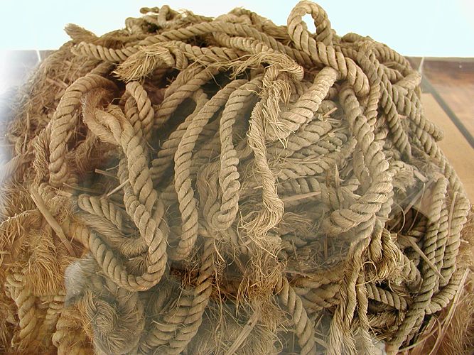
The archaeological site of Wadi Gawasis, discovered by Kathryn Bard and Rodolfo Fattovich on the Egyptian Red Sea coast, has provided the first direct physical evidence of these Red Sea expeditions. Excavations revealed ship timbers, coils of rope, cargo boxes inscribed with the names of Middle Kingdom pharaohs, and man-made caves used for the storage and assembly of dismantled ships, confirming the ancient accounts and demonstrating that the Egyptians built ocean-going vessels at the coast from components transported overland from the Nile Valley.10
Phoenician and Greek maritime traditions
The Phoenicians, the Semitic-speaking peoples of the Levantine coast centred on the cities of Tyre, Sidon, and Byblos, were the pre-eminent maritime traders of the first millennium BCE Mediterranean. Phoenician seafaring capabilities enabled the establishment of a commercial network spanning the entire Mediterranean basin, from the Levant to the Atlantic coast of Iberia, with colonies and trading posts at Cyprus, Sardinia, Sicily, North Africa (most notably Carthage, founded traditionally in 814 BCE), and southern Spain.11, 1
Phoenician ship design represented a significant advance over earlier Mediterranean traditions. Phoenician merchantmen were among the first vessels in the Mediterranean to employ a true keel, a heavy structural timber running the length of the hull bottom that provided longitudinal strength and improved sailing performance, particularly the ability to sail closer to the wind.2, 11 Phoenician vessels also employed edge-joined plank construction using mortise-and-tenon joints, a technique that produced a strong, watertight hull without relying on an internal frame, and which became the standard construction method throughout the Mediterranean until the early medieval period. The Late Bronze Age Uluburun shipwreck, dated to approximately 1300 BCE and excavated by Cemal Pulak off the southwestern coast of Turkey, provides the best-preserved example of this construction technique and its associated cargo: the vessel carried an astonishing array of trade goods including copper and tin ingots, glass ingots, ebony, ivory, gold and silver jewellery, and pottery from at least seven different cultures, illustrating the scale and complexity of Late Bronze Age maritime trade.12
Greek seafaring built upon and eventually surpassed Phoenician traditions, particularly in the development of the oared warship. The Greek trireme, the dominant naval weapon of the classical Mediterranean from the late sixth to the fourth century BCE, was a long, narrow warship propelled by 170 oarsmen arranged in three superimposed banks on each side, capable of reaching speeds of up to nine or ten knots in short bursts.18, 2 The trireme's primary weapon was its bronze-sheathed ram, a heavy projection at the waterline that could puncture an enemy vessel's hull below the waterline, and naval tactics centred on ramming required highly trained crews capable of executing precise manoeuvres at speed. The construction of the full-scale trireme replica Olympias in 1987, based on the research of John Morrison and John Coates, demonstrated that the ancient specifications were practicable and provided invaluable data on the vessel's performance characteristics.18
Major ancient vessel types and their characteristics1, 2
| Vessel type | Culture | Period | Construction | Primary use |
|---|---|---|---|---|
| Papyrus reed boat | Egyptian | 4th millennium BCE onward | Bundled papyrus reeds | Nile river transport |
| Khufu vessel | Egyptian | c. 2500 BCE | Cedar plank, mortise-and-tenon | Ceremonial / royal |
| Round ship | Phoenician | 1st millennium BCE | Keeled, mortise-and-tenon plank | Long-distance trade |
| Trireme | Greek | 6th–4th century BCE | Shell-first, 170 oars | Naval warfare |
| Dhow | Arab / Indian Ocean | 1st millennium CE onward | Sewn plank, lateen sail | Monsoon trade |
| Junk | Chinese | Han dynasty onward | Flat-bottomed, watertight bulkheads | Trade, warfare |
| Longship | Viking | 8th–11th century CE | Clinker-built, shallow draft | Raiding, exploration, trade |
| Double-hulled canoe | Polynesian | c. 1500 BCE onward | Dugout hulls, lashed crossbeams | Ocean voyaging, colonization |
Monsoon sailing and Indian Ocean trade
The Indian Ocean was the arena of the ancient world's most extensive maritime trade network, connecting the coasts of East Africa, Arabia, India, Southeast Asia, and China in a commercial system that exchanged spices, textiles, precious stones, metals, and other goods across thousands of kilometres of open water. The key to Indian Ocean navigation was the monsoon wind system: the southwest monsoon, blowing from roughly June to September, carried vessels from the western Indian Ocean coast toward India, while the northeast monsoon, blowing from November to February, carried them back, creating a predictable annual cycle of outbound and return voyages that made regular long-distance trade practicable.8, 17
The most important ancient literary source for Indian Ocean trade is the Periplus of the Erythraean Sea, a Greek merchant's guide written in the mid-first century CE that describes the ports, commodities, and sailing routes of the Red Sea, the coast of East Africa, the Arabian peninsula, and the western coast of India in remarkable practical detail.8 The Periplus reveals a sophisticated commercial system in which Roman merchants exported gold, silver, wine, glass, and manufactured goods from Mediterranean ports and imported pepper, cinnamon, silk, pearls, precious stones, and other luxury goods from India and beyond. The text also describes the crucial role of the monsoon winds and credits the Greek navigator Hippalus with the "discovery" of the direct monsoon route across the open Indian Ocean to India, though Arab and Indian sailors had almost certainly been exploiting the monsoon system for centuries before Greek involvement.8, 17
The vessels that plied the Indian Ocean trade routes were primarily sewn-plank boats, constructed not with nails or pegs but with coconut-fibre cord stitching the hull planks together, a technique that produced a flexible hull well suited to the swells of the open Indian Ocean. The lateen (triangular) sail, which became the characteristic rig of the Arab dhow, allowed these vessels to sail efficiently across the wind, an essential capability for monsoon sailing. Indian and Southeast Asian maritime traditions developed their own distinctive vessel types, including the large outrigger canoes and sewn-plank ships that carried the Austronesian expansion across Island Southeast Asia and into the Pacific and Indian Oceans.1, 17
Chinese maritime technology
Chinese shipbuilding developed along a distinctly different trajectory from Mediterranean traditions, producing vessels with several innovative features that would not appear in Western ship design for centuries. The most significant Chinese contribution to naval architecture was the use of watertight transverse bulkheads, internal walls that divided the hull into separate compartments. If the hull was breached in one compartment, the flooding was contained, greatly enhancing the vessel's survivability — a principle not adopted in European shipbuilding until the eighteenth century.14, 1 Chinese vessels also employed flat bottoms (rather than the keeled construction standard in the Mediterranean), sternpost rudders (centuries before their appearance in Europe), and multiple masts carrying battened lugsails that could be easily reefed and were efficient on a variety of points of sail.14
Joseph Needham's monumental Science and Civilisation in China documented the early development of these technologies, many of which were in use by the Han dynasty (206 BCE–220 CE) and fully mature by the Tang (618–907 CE) and Song (960–1279 CE) dynasties. The Song dynasty in particular witnessed a dramatic expansion of Chinese maritime commerce, with large junks carrying hundreds of passengers and tons of cargo on regular voyages to Southeast Asia, India, the Persian Gulf, and the east coast of Africa.14, 1 The Belitung shipwreck, a ninth-century Arab or Southeast Asian vessel discovered off the coast of Indonesia carrying over 60,000 pieces of Tang dynasty ceramics and other Chinese trade goods, provides dramatic archaeological evidence of the scale of maritime trade between China and the Indian Ocean world during the Tang period.20
Viking longships and North Atlantic expansion
The Viking Age (c. 793–1066 CE) produced one of history's most remarkable maritime cultures. The Scandinavian longship, a clinker-built (overlapping plank) vessel with a shallow draft, symmetrical bow and stern, and a single square sail supplemented by oars, was a versatile craft capable of ocean voyaging, river navigation, and beaching on open shorelines — a combination of capabilities that made it the instrument of Scandinavian expansion across an astonishing geographic range, from the rivers of Russia to the coasts of North America.13, 5
The finest surviving examples of Viking ship construction are the ninth-century vessels recovered from burial mounds at Oseberg and Gokstad in Norway. The Gokstad ship, approximately 23 metres long and 5 metres wide, was a seagoing vessel of exceptional craftsmanship, its hull formed from overlapping oak planks riveted together and caulked with animal hair and tar, achieving a combination of strength, flexibility, and lightness that allowed it to flex with ocean swells rather than resisting them rigidly.13 Modern replica voyages have demonstrated that vessels of this type were capable of sustained ocean passages: the Gokstad replica Viking crossed the Atlantic in 1893, and numerous subsequent replicas have confirmed the type's seaworthiness in North Atlantic conditions.13, 5
Viking maritime capability enabled the colonization of the Faroe Islands (c. 825 CE), Iceland (c. 870 CE), Greenland (c. 985 CE), and the brief settlement at L'Anse aux Meadows in Newfoundland (c. 1000 CE), the first confirmed European presence in the Americas. These North Atlantic voyages were accomplished without magnetic compasses or written charts, relying instead on knowledge of prevailing winds, ocean currents, the behaviour of seabirds and marine mammals, and astronomical observations, including the use of the sun's position and possibly a "sunstone" (a crystal of Iceland spar that can detect the sun's direction through overcast skies by polarising light).5, 13
Polynesian wayfinding and Pacific colonization
The colonization of the Pacific Ocean by Polynesian peoples represents arguably the greatest feat of navigation and seamanship in human history. Beginning from the Lapita cultural complex in the Bismarck Archipelago around 1500 BCE, Austronesian-speaking peoples expanded eastward across the vast Pacific, reaching Fiji, Tonga, and Samoa by approximately 900 BCE, and then, after a pause of over a millennium, colonizing the remaining islands of the Polynesian Triangle — Hawaii, Easter Island (Rapa Nui), and New Zealand (Aotearoa) — in a burst of exploration between roughly 1000 and 1300 CE.19, 7
Polynesian voyaging canoes were double-hulled or outrigger vessels constructed from hollowed-out logs, lashed together with sennit (braided coconut fibre) and fitted with claw-shaped or spritsails woven from pandanus leaves. The double-hulled canoe in particular provided a stable platform capable of carrying the passengers, livestock (pigs, chickens, dogs), crop plants (taro, yam, breadfruit, sweet potato, coconut), and fresh water necessary to establish viable colonies on distant islands.6, 7 Geoffrey Irwin's analysis of Polynesian colonization patterns demonstrated that the expansion was not haphazard but strategically organised, with voyagers initially exploring into the prevailing easterly trade winds, which ensured that they could return home by sailing downwind if no new land was found, a "safe return" strategy that minimised the risk of permanent loss at sea.7
The navigation techniques employed by Polynesian wayfinders were extraordinary in their sophistication, enabling open-ocean voyages of thousands of kilometres without instruments. David Lewis, who sailed with traditional navigators in the 1960s and 1970s, documented a system of non-instrument navigation based on a "star compass" — knowledge of the rising and setting positions of stars and star paths across the sky — supplemented by observation of ocean swell patterns, wind direction, cloud formations, the flight paths of land-based birds, the colour and temperature of the water, and the presence of phosphorescent organisms.6 Navigators memorised vast bodies of environmental knowledge transmitted orally across generations, and the most skilled could maintain course across hundreds of kilometres of open ocean with remarkable accuracy. The revival of traditional Polynesian navigation in the late twentieth century, most notably the voyages of the Hawaiian canoe Hōkūle'a beginning in 1976, has confirmed the practicability of these techniques and rekindled cultural pride in Polynesian maritime heritage.6, 7
Underwater archaeology and the study of ancient ships
The systematic study of ancient seafaring has been transformed by the development of underwater archaeology, which has made it possible to recover and study the physical remains of ancient ships and their cargoes that would otherwise be invisible to conventional archaeological methods. Prior to the mid-twentieth century, knowledge of ancient ship construction was derived almost entirely from artistic representations, literary descriptions, and the occasional vessel preserved in burial or waterlogged terrestrial contexts. The development of SCUBA diving and, later, remotely operated vehicles and submersibles opened the seabed to systematic archaeological investigation for the first time.15, 2
The pioneering work of George Bass at Cape Gelidonya (1960) and subsequently at Uluburun (1984–1994) off the Turkish coast established the methodology and standards of scientific underwater excavation. The Uluburun wreck, dated to approximately 1300 BCE, yielded one of the most important assemblages of Late Bronze Age material culture ever recovered, with its cargo of copper and tin ingots, glass, ivory, precious metals, and goods from at least seven different cultural traditions providing a snapshot of the complex trading networks that linked the civilizations of the eastern Mediterranean in the Late Bronze Age.12, 15
Subsequent discoveries have expanded the temporal and geographic range of underwater archaeology enormously. Roman shipwrecks are found throughout the Mediterranean in extraordinary numbers — over 1,500 have been catalogued — providing statistical data on the volume and patterns of Roman maritime trade that no literary source could match. The Antikythera wreck (c. 70–60 BCE), discovered off the Greek island of Antikythera, yielded the celebrated Antikythera mechanism, a sophisticated bronze geared device for computing astronomical positions that demonstrates a level of mechanical engineering not matched again until the medieval period.15, 2 In Asian waters, the Belitung wreck (c. 830 CE), with its cargo of over 60,000 pieces of Tang dynasty ceramics, has provided dramatic evidence of the scale of ninth-century maritime trade between China and the Middle East, while medieval shipwrecks in Scandinavian waters have illuminated the construction techniques and trade networks of the Viking world.20, 13
The future of underwater archaeology lies increasingly in deep-water investigation using remotely operated vehicles and autonomous underwater vehicles, technologies that are opening the vast majority of the ocean floor — previously inaccessible to divers — to archaeological survey and excavation. The anaerobic conditions of deep-water sites often preserve organic materials, including hull timbers, ropes, textiles, and foodstuffs, that would long since have decayed in shallower waters, offering the prospect of recovering information about ancient seafaring, trade, and daily life at sea that has been lost from every other archaeological context. As these technologies mature, the archaeological record of ancient seafaring will continue to expand, deepening understanding of one of the most fundamental and far-reaching of all human technological achievements.15, 1