Overview
- Loess is wind-deposited silt — angular quartz grains typically 20 to 50 micrometres in diameter — that blankets approximately 10 percent of Earth's land surface and forms some of the most agriculturally productive soils in the world, including the breadbaskets of the American Great Plains, the Ukrainian steppe, and the Chinese Loess Plateau.
- The Chinese Loess Plateau preserves the thickest and most continuous loess sequence on Earth, exceeding 300 metres in places, with alternating layers of loess (deposited during cold, dry glacials) and paleosols (soils formed during warm, humid interglacials) that provide a detailed continental climate record spanning the past 2.6 million years.
- Magnetic susceptibility measurements of loess-paleosol sequences have proven to be a powerful paleoclimate proxy, correlating closely with deep-sea oxygen isotope records and confirming that the alternation of loess deposition and soil formation is driven by the same orbital forcing (Milankovitch cycles) that paces glacial-interglacial climate oscillations.
Loess (pronounced "luss" or "löss") is a fine-grained, wind-deposited sediment composed predominantly of silt-sized particles, typically quartz grains between 20 and 50 micrometres in diameter. It blankets approximately 10 percent of Earth's land surface — one of the most extensive continental sedimentary deposits on the planet — forming mantles that drape the underlying topography and can reach thicknesses of several hundred metres. Loess is intimately connected to glacial climate: most of the world's loess was produced during the cold, dry phases of the Pleistocene ice ages, when glaciers ground bedrock into fine rock flour, outwash plains exposed vast quantities of silt to the wind, and reduced vegetation cover permitted deflation and long-distance atmospheric transport. The resulting deposits are far more than geological curiosities — they create some of the most fertile soils on Earth, preserve a detailed archive of Quaternary climate change, and present distinctive geotechnical hazards that have shaped human settlement and engineering practice for millennia.1, 2
Formation and transport
The production of loess begins with the generation of silt-sized mineral particles, primarily through glacial grinding. As glaciers flow over bedrock, the enormous pressure and abrasion at the ice-rock interface crushes and fractures the rock into a wide range of grain sizes, from clay to sand, with an abundant fraction in the silt range. This glacially produced silt, known as rock flour, is carried by meltwater streams and deposited on broad, unvegetated outwash plains (sandurs) downstream of the ice margin. During dry periods and particularly during winter, when meltwater discharge ceases and the outwash surface dries, strong winds deflate the exposed silt and carry it downwind in suspension clouds that can travel hundreds or thousands of kilometres before depositing the material as loess.1, 2
Not all loess is glaciogenic. In Central Asia and the deserts of China, silt production occurs through physical weathering processes — frost shattering, salt weathering, and thermal cycling — operating on exposed desert surfaces and mountain slopes. The Taklamakan and Gobi deserts are major dust source regions for the Chinese Loess Plateau, and the silt they produce is transported by the prevailing westerly and northwesterly winds of the East Asian monsoon system. Fluvial comminution — the progressive reduction of grain size during river transport — also contributes silt to some loess-forming systems. Regardless of the source mechanism, the common element is wind transport and deposition: loess is, by definition, an aeolian sediment.2, 5
The rate of loess deposition decreases with distance from the source, producing a systematic downwind fining and thinning of the deposit. Near the source, loess is thickest and coarsest (sandy silt); farther downwind, it becomes thinner and finer (clayey silt). This spatial gradient is well documented on the Chinese Loess Plateau, where deposits exceeding 300 metres in thickness near the desert margins thin to less than 10 metres several hundred kilometres to the southeast, and in the North American Great Plains, where Peoria Loess thins eastward from its Missouri River valley source.5, 7
Physical properties
Loess has a suite of physical properties that distinguish it from other sedimentary deposits and give it characteristic engineering and landscape behaviour. The grains are predominantly angular to subangular silt-sized quartz, reflecting their origin by mechanical fracturing rather than chemical weathering. This angularity, combined with a light coating of clay and calcium carbonate cement, allows loess particles to interlock in a metastable open-pore structure with porosities of 40 to 55 percent — far higher than most consolidated sediments of comparable grain size.2, 10
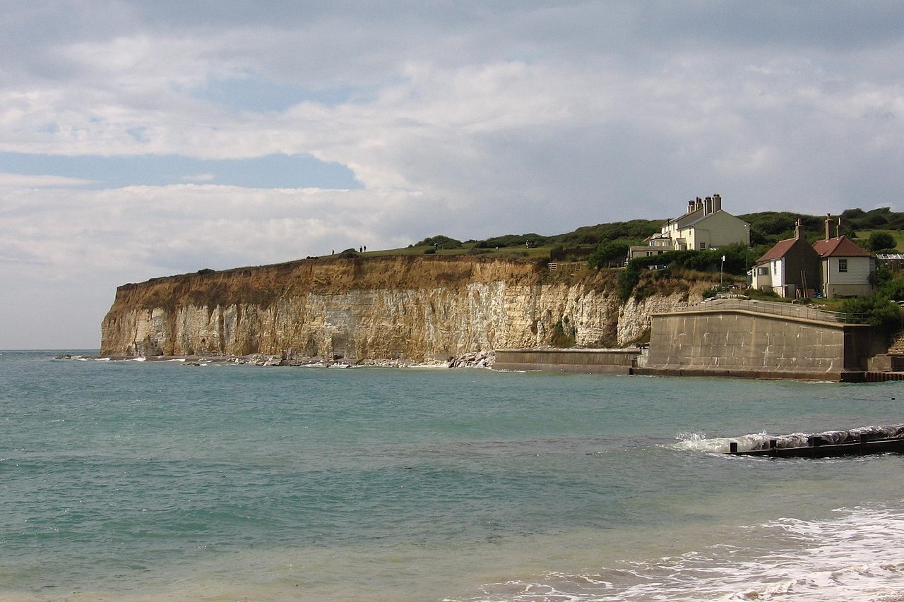
The open-pore structure is responsible for two of loess's most distinctive characteristics. First, it gives loess the ability to stand in near-vertical cliffs, sometimes tens of metres high, without collapsing under its own weight — a property that has been exploited for millennia by communities who have carved cave dwellings (yaodongs) into the loess cliffs of China's Loess Plateau. The vertical cliffing results from the combination of intergranular cementation by calcium carbonate, the surface tension of capillary water in the fine pores, and the interlocking of angular grains. Dry loess can maintain vertical faces indefinitely, but the structure is critically sensitive to water saturation.10
Second, and dangerously, the open-pore structure makes loess susceptible to sudden hydrocompaction (or collapse) when saturated. When water infiltrates the pore spaces, it dissolves the carbonate cement and eliminates capillary tension, causing the grain framework to collapse abruptly. The resulting ground settlement can be catastrophic: collapses of 10 to 15 percent of the original deposit thickness have been documented, causing severe damage to buildings, roads, canals, and other infrastructure founded on loess. This collapse susceptibility is the dominant geotechnical hazard associated with loess and requires special foundation treatments including pre-wetting, compaction, or deep foundation piling in construction projects on loess terrain.10, 11
The Chinese Loess Plateau
The Chinese Loess Plateau, stretching across approximately 640,000 square kilometres of north-central China in the provinces of Shaanxi, Shanxi, Gansu, and Ningxia, is the thickest, most extensive, and most intensively studied loess deposit on Earth. In places, particularly near the northwestern margin closest to the desert source areas, loess accumulations exceed 300 metres in thickness, representing nearly continuous aeolian deposition over the past 2.6 million years — the entire duration of the Quaternary ice age.5, 4
The Plateau's significance extends far beyond its sheer size. The loess sequence preserves a remarkably detailed record of Quaternary climate change in the form of alternating loess and paleosol (fossil soil) layers. During cold, dry glacial periods, when the East Asian winter monsoon strengthened and dust production from the Gobi and Taklamakan deserts intensified, silt was deposited rapidly, producing thick layers of unweathered, pale yellow loess. During warm, humid interglacial periods, the summer monsoon brought increased rainfall to the Plateau, dust deposition slowed, and the loess surface weathered into a reddish-brown soil through pedogenic processes — clay formation, iron oxide accumulation, organic matter enrichment, and bioturbation. These paleosols, preserved and buried by subsequent loess deposition, mark each interglacial interval as a distinct, darker horizon within the pale loess stack.5, 9
The Chinese loess-paleosol sequence has been correlated with the deep-sea oxygen isotope record — the standard reference for Quaternary climate oscillation — and the match is striking. Every major glacial-interglacial cycle identified in the marine record has a corresponding loess-paleosol couplet on the Plateau, extending back through more than thirty glacial cycles to the onset of Northern Hemisphere glaciation around 2.6 million years ago. This correlation confirms that the loess-paleosol alternation is driven by the same orbital forcing — changes in Earth's eccentricity, obliquity, and precession — that paces the global ice age cycles.4, 6, 9
Magnetic susceptibility as climate proxy
Among the most powerful tools for extracting climate information from loess-paleosol sequences is the measurement of magnetic susceptibility — the degree to which a material becomes magnetized when placed in an external magnetic field. In the Chinese loess, magnetic susceptibility varies dramatically between loess layers (low values) and paleosols (high values), providing a continuous, high-resolution proxy for climate that can be measured rapidly and non-destructively.3
The mechanism linking magnetic susceptibility to climate operates through pedogenesis. During warm, wet interglacial periods, chemical weathering and biological activity in the developing soil produce ultrafine ferrimagnetic minerals — primarily maghemite and magnetite nanoparticles — through a process called pedogenic enhancement. These nanoparticles, typically 20 to 30 nanometres in diameter, are superparamagnetic and contribute strongly to the bulk magnetic susceptibility of the paleosol. During cold, dry glacial periods, pedogenesis is minimal, and the deposited loess retains only the weak magnetic signal of its detrital mineral assemblage. The contrast produces a magnetic susceptibility curve that mirrors the loess-paleosol stratigraphy and, by extension, the global glacial-interglacial record.3, 9
Barbara Maher and Roy Thompson demonstrated in 1995 that the magnetic susceptibility record of the Chinese loess correlates closely with the marine oxygen isotope record, confirming its value as a climate proxy independent of the marine system. The magnetic susceptibility signal can be measured at centimetre-scale intervals through continuous loess sections, providing temporal resolution that in some cases exceeds that of the deep-sea record. The method has since been applied to loess deposits worldwide and remains one of the standard analytical techniques in Quaternary palaeoclimate research.3
Global distribution
Loess deposits occur on every continent except Antarctica, concentrated in two broad latitudinal belts: the mid-latitudes of the Northern Hemisphere (approximately 30° to 55° N) and a narrower band in the Southern Hemisphere (approximately 30° to 40° S in South America). This distribution reflects the geography of Pleistocene ice sheets, outwash plains, and prevailing wind patterns.1, 2
In North America, the most extensive loess deposits occur in the Great Plains and the Mississippi River valley, where silt derived from glacial outwash was deflated from the Missouri, Mississippi, and other rivers and deposited in a belt extending from Nebraska and Kansas eastward through Iowa, Illinois, and Indiana. The Peoria Loess, deposited during the last glacial maximum (approximately 25,000 to 12,000 years ago), is the youngest and most widespread unit, reaching thicknesses of 30 to 40 metres along the Missouri River bluffs and thinning eastward. Older loess units, dating to earlier glaciations, are preserved beneath the Peoria in a stack of loess-paleosol couplets analogous to, though much thinner than, the Chinese sequence.7
European loess forms a broad belt stretching from Normandy across Belgium, the Netherlands, Germany, Poland, and Ukraine, and extends south into the Danube basin through Austria, Hungary, Serbia, and Romania. The thickest European deposits, reaching 40 to 60 metres, occur along the Rhine and Danube rivers and in the Ukrainian steppe. European loess sequences typically preserve three to five loess-paleosol couplets spanning the last several hundred thousand years, and they have been instrumental in establishing the Quaternary chronostratigraphy of the continent.8
In Central Asia, loess covers vast areas of Tajikistan, Uzbekistan, and Kyrgyzstan, where deposits exceeding 200 metres in thickness record dust input from the desert basins of the Karakum and Kyzylkum. The Central Asian loess preserves a palaeoclimate record that bridges the European and Chinese sequences geographically and chronologically. In the Southern Hemisphere, the Argentine Pampas contain the most extensive loess deposits, derived from Andean volcanism and glacial activity, and forming the basis of Argentina's extraordinarily productive agricultural soils.15, 2
Agricultural significance
The agricultural importance of loess soils is difficult to overstate. The physical and chemical properties of loess — its silt-sized grain distribution, high porosity, calcium carbonate content, and ease of tillage — produce some of the most naturally fertile soils on Earth. Loess-derived soils hold moisture well due to their fine pore structure, yet drain adequately to prevent waterlogging. Their calcium carbonate content buffers soil acidity, and the mineral assemblage supplies essential plant nutrients including potassium, calcium, and magnesium. The open texture of loess makes it easy to plough, and its capacity to retain moisture through drought periods makes loess soils resilient under rainfed agriculture.2, 7
The world's major breadbaskets are, to a remarkable degree, loess landscapes. The Corn Belt of the American Midwest — Iowa, Illinois, Indiana — is underlain by Peoria Loess, and the deep, black prairie soils (Mollisols) developed on this loess are among the most productive agricultural soils in the world. The chernozem soils of Ukraine and southern Russia, the foundation of one of the world's great grain-producing regions, are developed on loess. The loess soils of northern France (the Beauce and Picardy regions) produce exceptional wheat yields. On the Chinese Loess Plateau, agriculture has been practiced for at least 7,000 years, and the region was the cradle of Chinese civilization, though severe erosion from millennia of cultivation has degraded much of the Plateau's productivity.5, 7, 8
Geotechnical hazards
The same open-pore structure that makes loess agriculturally productive creates severe geotechnical hazards when loess is used as foundation material or excavated for construction. The most dangerous property is hydrocompaction — the sudden collapse of the metastable grain structure when the loess is saturated with water. Hydrocompaction can cause ground settlement of 1 to 3 metres over areas of tens to hundreds of square metres, with devastating consequences for buildings, roads, canals, and pipelines. In the loess regions of Central Asia and China, leaking irrigation canals have triggered catastrophic collapses affecting entire villages.10, 11
Loess is also highly susceptible to erosion, both by water and by mass wasting. Rainfall on loess generates deep gullies with near-vertical walls, producing the spectacular badland topography of the Chinese Loess Plateau, where erosion rates exceed 10,000 tonnes per square kilometre per year in the most severely affected areas. Landslides in loess — often triggered by earthquakes, heavy rainfall, or irrigation-related saturation — can be extremely rapid and destructive. The 1920 Haiyuan earthquake in Gansu Province, China, triggered massive loess landslides that buried entire towns and killed approximately 200,000 people, making it one of the deadliest landslide disasters in recorded history.10
Dust, orbital forcing, and climate feedback
Loess deposits are the terrestrial archive of a global dust cycle that is itself a significant component of the climate system. During glacial periods, the concentration of mineral dust in the atmosphere increased by a factor of two to five compared to interglacial levels, as recorded in Antarctic ice cores, deep-sea sediments, and the loess record itself. This increase reflects the greater availability of deflatable material (expanded deserts, exposed outwash plains, reduced vegetation cover), stronger and more persistent winds, and reduced precipitation to wash dust from the atmosphere.12
Atmospheric dust plays multiple roles in the climate system. It scatters and absorbs solar radiation, altering the planetary energy budget; it serves as nuclei for cloud droplet and ice crystal formation, affecting cloud properties and precipitation; and it delivers iron and other micronutrients to the ocean surface, stimulating phytoplankton productivity in iron-limited regions. Martínez-García and colleagues demonstrated in 2014 that iron fertilization of the Southern Ocean by enhanced glacial dust flux stimulated biological carbon export, drawing down atmospheric CO2 and amplifying glacial cooling — a direct feedback loop linking dust production, ocean biology, and global climate.14
The pacing of dust production follows the Milankovitch orbital cycles that drive glacial-interglacial oscillations. Eccentricity (100,000-year period), obliquity (41,000 years), and precession (23,000 years) all appear in the spectral analysis of loess accumulation rate records, confirming that orbital forcing controls not only the ice sheets and ocean temperatures but also the continental dust cycle and its downstream effects on atmospheric chemistry, ocean productivity, and soil formation. The loess record thus provides a uniquely terrestrial perspective on the same climate rhythms recorded in ice cores and marine sediments.6, 13
Dating loess deposits
Establishing the chronology of loess deposits is essential for correlating them with other palaeoclimate records and for understanding the rates of aeolian processes. Several dating methods are applied to loess, each suited to different time ranges and deposit characteristics. Radiocarbon dating of organic material (charcoal, humic acids, land snails) within loess can be applied to deposits younger than approximately 50,000 years, though contamination by younger carbon often limits reliability. Magnetostratigraphy — the identification of polarity reversals in the loess's remanent magnetization — provides tie points to the geomagnetic polarity timescale, with the Brunhes-Matuyama reversal at 780,000 years ago serving as a key marker in Chinese and Central Asian sequences.9
The most widely applicable method is luminescence dating, which measures the accumulated radiation dose absorbed by mineral grains (quartz or feldspar) since they were last exposed to sunlight during wind transport. Optically stimulated luminescence (OSL) dating of quartz is routinely applied to loess deposits up to approximately 150,000 years old, and infrared stimulated luminescence (IRSL) of feldspar can extend the range to several hundred thousand years. Luminescence dating has been transformative for loess chronology because it dates the depositional event directly — the moment the grain was buried — rather than relying on associated organic or magnetic materials.16
References
Magnetic susceptibility of the Chinese loess-palaeosol sequence: environmental change and pedogenesis