Overview
- Sequence stratigraphy is a method of subdividing sedimentary successions into genetically related packages bounded by unconformities and their correlative conformities, providing a predictive framework for understanding how basins fill in response to changes in sea level, tectonics, and sediment supply.
- Originating from Sloss's recognition of continent-wide unconformity-bounded sequences in the 1960s and formalized through the seismic stratigraphic work of Vail, Mitchum, and colleagues at Exxon in the 1970s, the discipline introduced systems tracts, key bounding surfaces, and the concept of accommodation space as the fundamental controls on stratigraphic architecture.
- The approach has become indispensable in petroleum exploration for predicting the distribution of reservoir, source, and seal rocks, while its integration with biostratigraphy, chemostratigraphy, and numerical modelling continues to refine our understanding of Earth's sedimentary record and sea-level history.
Sequence stratigraphy is a method of analyzing the sedimentary rock record by subdividing it into genetically related packages of strata — called depositional sequences — that are bounded by unconformities and their correlative conformities. Unlike traditional lithostratigraphy, which classifies rocks by their physical properties, or biostratigraphy, which correlates strata using fossil content, sequence stratigraphy emphasizes the genetic relationships among strata and the surfaces that bound them, providing a predictive framework for understanding how sedimentary basins fill over time.2, 16 The approach integrates information from seismic reflection profiles, well logs, cores, and outcrops to reconstruct the interplay between changes in relative sea level, tectonic subsidence, and sediment supply that governs the architecture of sedimentary successions worldwide.7, 14
Since its formalization in the late 1970s, sequence stratigraphy has transformed both academic stratigraphy and the petroleum industry. By enabling geologists to predict the spatial and temporal distribution of reservoir, source, and seal rocks within a basin, the method has become one of the most powerful tools in hydrocarbon exploration and production.23 At the same time, its theoretical underpinnings — particularly the question of whether global sea-level changes can be read from the stratigraphic record — have provoked vigorous debate that has sharpened the discipline and led to successive refinements in methodology and nomenclature.12, 14, 15
Historical foundations
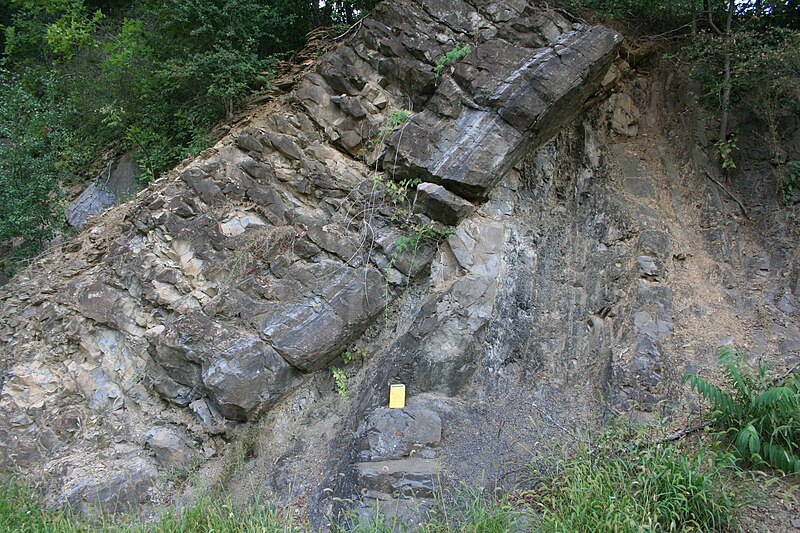
The intellectual roots of sequence stratigraphy extend to the mid-twentieth century, when the American stratigrapher Laurence Sloss recognized that the sedimentary cover of the North American craton could be divided into a small number of large-scale, continent-wide packages separated by interregional unconformities. In his landmark 1963 paper, Sloss designated six such packages — from oldest to youngest, the Sauk, Tippecanoe, Kaskaskia, Absaroka, Zuni, and Tejas sequences — each bounded by surfaces that could be traced across the entire stable continental interior.1 Sloss's sequences were unconformity-bounded rock units of supergroup rank or higher, and he interpreted them as the stratigraphic record of major transgressions and regressions of the sea across the craton. Although the term "sequence" had been used informally before, Sloss gave it a formal stratigraphic meaning that would prove foundational: a body of strata bounded above and below by unconformities of interregional extent.1

The transformation of Sloss's concept into a comprehensive stratigraphic method came in the 1970s through the work of Peter Vail, Robert Mitchum, and their colleagues at Exxon Production Research Company. Working with proprietary seismic reflection data from passive continental margins around the world, Vail and Mitchum recognized that the geometry of seismic reflections — their patterns of termination against bounding surfaces — could be used to identify depositional sequences and to reconstruct the history of relative sea-level change that controlled their architecture.2, 3 Their findings were published in 1977 as a series of papers in AAPG Memoir 26, a volume that is widely regarded as the founding document of modern seismic stratigraphy. Mitchum, Vail, and Thompson refined Sloss's definition, redefining a depositional sequence as "a stratigraphic unit composed of a relatively conformable succession of genetically related strata and bounded at its top and base by unconformities or their correlative conformities."2 The crucial addition of "correlative conformities" extended the concept from the cratonic setting into marine basins, where unconformities pass laterally into conformable sections.
In the same volume, Vail, Mitchum, and Thompson introduced the technique of measuring relative changes in sea level from the patterns of coastal onlap visible on seismic profiles, and they published a global chart of sea-level cycles spanning much of the Phanerozoic.3 This chart, subsequently refined by Haq, Hardenbol, and Vail in 1987 and 1988, became both enormously influential and deeply controversial, as it implied that sea-level changes could be correlated globally with a precision that many stratigraphers questioned.8, 24
Key concepts and definitions
At the heart of sequence stratigraphy lies the concept of accommodation, defined by Jervey in 1988 as the space available for potential sediment accumulation, measured as the distance between the sea floor (or land surface) and a reference horizon such as sea level.6 Accommodation is created by subsidence of the basin floor (through tectonic extension, thermal cooling, or sediment loading) and by rises in eustatic sea level; it is destroyed by tectonic uplift and falls in eustatic sea level. The stratigraphic record at any given location reflects the interplay between the rate at which accommodation is created or destroyed and the rate at which sediment is supplied to fill that accommodation.6, 16
A depositional sequence is the fundamental unit of sequence stratigraphic analysis. As defined by Mitchum, Vail, and Thompson, it is a relatively conformable succession of genetically related strata bounded by unconformities or their correlative conformities.2 The unconformities that bound sequences are produced when the rate of eustatic sea-level fall exceeds the rate of subsidence, exposing formerly submerged areas to subaerial erosion. Basinward of the zone of erosion, the unconformity passes into a correlative conformity — a continuous surface that is recognizable in the subsurface through changes in stratal geometry or facies but that does not represent a gap in deposition.2, 4
A parasequence, introduced by Van Wagoner and colleagues, is a relatively conformable, genetically related succession of beds or bedsets bounded by marine flooding surfaces and their correlative surfaces.4, 7 Parasequences are the building blocks of sequences: they record individual shoaling-upward cycles, typically on the scale of metres to tens of metres, in which sediment progrades during a period of slow relative sea-level rise and is then abruptly flooded when the rate of sea-level rise outpaces sediment supply. Parasequences stack into parasequence sets whose geometry — progradational, retrogradational, or aggradational — reflects the longer-term balance between accommodation creation and sediment supply.7
Key bounding surfaces
Sequence stratigraphy recognizes several types of stratigraphically significant surfaces, each defined by a distinctive set of physical, sedimentological, and geophysical characteristics. These surfaces partition the sedimentary record into systems tracts and provide the framework for regional and global correlation.14, 15
The sequence boundary is the most prominent surface in the sequence stratigraphic hierarchy. It is an unconformity formed during a relative fall in sea level, when the shoreline is forced seaward and previously deposited sediments are exposed to erosion. On seismic profiles, the sequence boundary is identified by reflection terminations such as toplap, truncation, and onlap. In the landward direction, the surface may exhibit incised valleys, karst features, or paleosol development; basinward, it passes into the correlative conformity.2, 4, 16
The transgressive surface (also called the transgressive ravinement surface) marks the first significant flooding event above the lowstand deposits. It is the boundary between the lowstand and transgressive systems tracts and is characterized by a landward shift in facies, often accompanied by a thin lag of coarse sediment produced by wave erosion during transgression.4, 7
The maximum flooding surface records the time of greatest marine influence, when the shoreline has transgressed to its most landward position and the rate of accommodation creation is at its maximum relative to sediment supply. It separates the transgressive systems tract from the overlying highstand systems tract. In the rock record, maximum flooding surfaces are commonly associated with condensed sections — thin intervals of slowly deposited, fossil-rich, fine-grained sediment that accumulate during transgressive maxima when clastic input is minimal.4, 9 Galloway's alternative approach to sequence stratigraphy uses the maximum flooding surface, rather than the subaerial unconformity, as the primary bounding surface, defining units he termed genetic stratigraphic sequences.9
The basal surface of forced regression marks the onset of relative sea-level fall and the beginning of forced regression, when the shoreline is driven seaward regardless of sediment supply. This surface was formally recognized by Hunt and Tucker in 1992 and separates the highstand deposits below from the falling-stage deposits above.10
Systems tracts
Within each depositional sequence, the strata are subdivided into systems tracts: packages of contemporaneous depositional systems that are genetically linked to a specific phase of the relative sea-level cycle. The systems tract concept was introduced by Posamentier, Vail, and colleagues in 1988 and subsequently refined through the addition of the falling-stage systems tract by Hunt and Tucker in 1992.5, 10 The four-systems-tract model that is now widely adopted divides each sequence into a falling-stage, lowstand, transgressive, and highstand systems tract, each occupying a characteristic position within the cycle of accommodation change.14, 15
The highstand systems tract (HST) is deposited during the late phase of relative sea-level rise and the early stage of stillstand, when accommodation creation is slowing and sediment supply exceeds the rate at which new space is being generated. Stacking patterns in the HST are typically aggradational to progradational, with clinoforms building outward and upward from the shelf edge. River deltas, coastal plains, and prograding shoreface deposits are characteristic components.5, 7
The falling-stage systems tract (FSST) encompasses all strata deposited during the interval of relative sea-level fall, from the onset of base-level decline to the lowest point. During forced regression, the shoreline migrates seaward regardless of sediment supply, and sharp-based shoreface deposits, detached lowstand wedges, and incised valleys may form as the shelf is progressively exposed and eroded. The FSST was first described by Hunt and Tucker as the "forced regressive wedge systems tract" and was independently recognized by Plint in his study of sharp-based shoreface sandstones in the Cretaceous Cardium Formation of Alberta.10, 19
The lowstand systems tract (LST) is deposited after relative sea level has reached its lowest point and begins to rise slowly, but before the rate of rise becomes rapid enough to cause transgression. Sediment accumulates primarily in the basin, on the lower slope and basin floor, in the form of submarine fans and slope apron deposits fed by sediment-gravity flows through incised valleys and slope channels. On the shelf, the incised valleys created during the preceding fall begin to fill with fluvial and estuarine sediments.5, 7
The transgressive systems tract (TST) records the interval of rapid relative sea-level rise, when the rate of accommodation creation exceeds the rate of sediment supply and the shoreline migrates landward. Parasequences within the TST display a retrogradational stacking pattern, with each successive unit stepping landward relative to its predecessor. Coastal deposits are thin and reworked; offshore, the transgression produces a condensed section of fine-grained, fossil-rich sediment.4, 5
Summary of systems tracts and their characteristics5, 10, 15
| Systems tract | Sea-level phase | Stacking pattern | Lower boundary | Upper boundary |
|---|---|---|---|---|
| Highstand (HST) | Late rise to early stillstand | Aggradational to progradational | Maximum flooding surface | Basal surface of forced regression |
| Falling-stage (FSST) | Sea-level fall | Forced progradation (downstepping) | Basal surface of forced regression | Sequence boundary |
| Lowstand (LST) | Early rise (post-fall) | Progradational to aggradational | Sequence boundary | Transgressive surface |
| Transgressive (TST) | Rapid rise | Retrogradational | Transgressive surface | Maximum flooding surface |
Accommodation, sediment supply, and driving mechanisms
The architecture of any sedimentary succession is ultimately controlled by two variables: the rate of change in accommodation and the rate of sediment supply. When accommodation creation outpaces sediment supply, the depositional system backsteps (retrogrades), stacking sediment in increasingly landward positions. When sediment supply exceeds accommodation creation, the system progrades, building outward into the basin. When the two are roughly in balance, the system aggrades vertically.6, 16 These three end-member behaviours — retrogradation, progradation, and aggradation — form the basis for interpreting stacking patterns in outcrop, well logs, and seismic data.
Accommodation itself is governed by the sum of two components: eustasy (changes in global ocean volume, driven by mid-ocean ridge volume, glacial ice volume, and water temperature) and subsidence or uplift (driven by tectonic processes including extensional faulting, thermal relaxation, flexural loading, and dynamic topography). Because relative sea-level change at any location is the combined effect of eustasy and tectonics, identical eustatic histories can produce fundamentally different stratigraphic architectures in basins with different subsidence rates.6, 16, 20
Sediment supply introduces a third independent variable. Even in a setting of constant relative sea level, changes in sediment flux — driven by climate, drainage reorganization, or hinterland tectonics — can produce cycles of progradation and retrogradation that mimic those produced by sea-level change. This recognition has led to a broadening of the sequence stratigraphic framework beyond its original sea-level-centric model to encompass allogenic (externally driven) and autogenic (internally generated) controls on sedimentation.16, 17
The global sea-level curve debate
No aspect of sequence stratigraphy has generated more controversy than the attempt to construct a global curve of eustatic sea-level change from the stratigraphic record. The original Vail curve of 1977, based on the interpretation of coastal onlap patterns on seismic profiles from multiple basins, depicted a series of rapid sea-level falls separated by slower rises — producing the distinctive "sawtooth" pattern that characterized the Exxon global cycle chart.3 Haq, Hardenbol, and Vail refined and extended this chart in 1987 and 1988, publishing what became the most widely cited sea-level curve in the geological literature, spanning the entire Mesozoic and Cenozoic with purported third-order resolution on the order of one to three million years.8, 24
Critics, most notably Andrew Miall, challenged the chart on multiple grounds. Miall argued in 1992 that the implied precision of the global cycle chart exceeded the resolution of the biostratigraphic methods used to date the sequences, making it impossible to demonstrate that sea-level events in different basins were truly synchronous rather than merely similar in age. He further contended that many apparent "cycles" could be explained by local tectonic events rather than global eustasy, and that the proprietary nature of the original Exxon seismic data made independent verification difficult.12 Miall later elaborated a "complexity paradigm" in which sequence architecture is viewed as the product of multiple interacting processes — eustasy, tectonics, sediment supply, and autogenic dynamics — rather than the expression of a single global sea-level signal.22
Independent efforts to reconstruct Phanerozoic sea-level history have yielded results that partially vindicate and partially challenge the Exxon curves. Miller and colleagues, using oxygen isotope records from deep-sea foraminifera and the stratigraphy of the tectonically stable New Jersey coastal plain, produced a Cenozoic and Late Cretaceous sea-level record that confirms the existence of many third-order cycles but assigns smaller amplitudes to some events and different ages to others.13 Long-term trends are broadly consistent across studies: sea level was approximately 100 to 250 metres higher than present during the Late Cretaceous greenhouse, reflecting both the absence of continental ice sheets and elevated mid-ocean ridge volumes, and has declined irregularly since the Eocene as ice sheets grew on Antarctica and later in the Northern Hemisphere.13, 21 However, the precise amplitudes, durations, and global synchroneity of shorter-term (third-order) cycles remain subjects of active investigation.
Competing models and standardization
The history of sequence stratigraphy has been marked by competing schools of thought, each differing in the choice of bounding surfaces and the nomenclature applied to the resulting stratigraphic units. The original depositional-sequence model of Vail, Mitchum, and colleagues uses the subaerial unconformity and its correlative conformity as the primary bounding surface, placing the sequence boundary at the position of maximum regression.2, 4 Galloway's genetic-stratigraphic-sequence model instead uses the maximum flooding surface as the bounding surface, arguing that flooding events are easier to identify in the subsurface and produce more laterally continuous markers for correlation.9 Embry's transgressive-regressive (T-R) sequence model employs the maximum regressive surface as its primary boundary, dividing each sequence into a transgressive and a regressive half.11
The proliferation of models created confusion in communication and hindered the acceptance of sequence stratigraphy as a formal branch of stratigraphy. In response, the International Subcommission on Stratigraphic Classification convened a working group that published two major consensus documents: Catuneanu and colleagues' "Towards the standardization of sequence stratigraphy" in 2009 and the more detailed "Sequence stratigraphy: methodology and nomenclature" in 2011.14, 15 These papers established a model-independent framework in which the fundamental concepts — accommodation, stacking patterns, key surfaces, and systems tracts — are agreed upon by all schools, while the choice of which surface to use as the primary sequence boundary is left to the practitioner based on data quality and geological context. The consensus recognized four systems tracts (falling-stage, lowstand, transgressive, and highstand) as the standard subdivision of a sequence, and defined seven model-independent surfaces of sequence stratigraphic significance.15
Neal and Abreu proposed an alternative hierarchical framework in 2009 termed the accommodation succession method, which defines sequence stratigraphic units based entirely on the geometric relationships of strata rather than on inferred sea-level histories. In this scheme, each full accommodation succession consists of a progression from progradation-dominated to aggradation-dominated to retrogradation-dominated geometries, and the hierarchy of sequences is determined by the stacking of these successions at multiple scales.18 This approach avoids the need to invoke a specific mechanism (such as eustasy) for each observed cycle and has gained traction as a purely descriptive tool for subsurface analysis.
Applications in petroleum exploration
Sequence stratigraphy has had its most immediate practical impact in the petroleum industry, where it provides a predictive framework for identifying and mapping the subsurface distribution of reservoir, source, and seal rocks. The logic is straightforward: because the geometry and facies distribution of sedimentary deposits are controlled by their position within a sequence and systems tract, knowledge of the sequence stratigraphic context allows the explorationist to predict where porous and permeable reservoir sands, organic-rich source shales, and impermeable sealing muds are likely to occur, even in areas of sparse well control.17, 23
Lowstand systems tract deposits are of particular interest for exploration because they may include basin-floor submarine fans and slope channels that contain thick, laterally extensive sand bodies deposited far from the contemporaneous shoreline. These lowstand sands are commonly encased in fine-grained marine mudstones that serve as both source rocks and seals, creating favourable conditions for hydrocarbon entrapment. Some of the world's most prolific deepwater reservoirs, including those in the Gulf of Mexico, offshore Brazil, and West Africa, are lowstand turbidite systems that were deposited during falls or lowstands of relative sea level and subsequently buried by transgressive and highstand muds.17, 23
Highstand systems tract deposits are important as well, particularly in deltaic and shallow-marine settings where prograding clinoforms create laterally extensive, sheet-like sand bodies that can serve as prolific reservoirs. Maximum flooding surfaces and their associated condensed sections, with their high organic content and distinctive log and seismic signatures, are widely used as correlation markers in both exploration and production settings, and the condensed sections themselves may function as source rocks in some basins.7, 9
At the reservoir scale, high-resolution sequence stratigraphy — applied to cores, well logs, and high-frequency seismic data — enables the identification of flow barriers and baffles within producing intervals. Parasequence boundaries, which are commonly draped by fine-grained sediment, can compartmentalize reservoirs and control the movement of fluids during production. Understanding the internal architecture of a reservoir in sequence stratigraphic terms allows engineers to optimize well placement, predict sweep efficiency during waterflooding, and estimate recoverable reserves more accurately.7, 23
Integration with other stratigraphic methods
Sequence stratigraphy does not operate in isolation.

_10.jpg)
Its power is greatly enhanced when integrated with other branches of stratigraphy, each of which provides independent constraints on the age, environment, and correlation of sedimentary strata. Biostratigraphy supplies the temporal framework essential for dating sequences and testing whether sea-level events are synchronous across basins. The maximum flooding surfaces that cap transgressive systems tracts are typically the most biostratigraphically well-constrained horizons in a succession because the associated condensed sections concentrate fossil material and are deposited slowly enough to capture detailed evolutionary and ecological changes.7, 9
Chemostratigraphy — the use of elemental and isotopic signatures to correlate strata — provides another powerful complement. Carbon and oxygen isotope excursions, strontium isotope ratios, and elemental proxies for redox conditions and productivity can be tied to specific positions within the sequence stratigraphic framework, enabling correlation in successions that lack diagnostic fossils. The oxygen isotope record from deep-sea benthic foraminifera has been particularly valuable for calibrating Cenozoic sea-level history, as the ratio of 18O to 16O in foraminiferal calcite reflects both water temperature and global ice volume.13, 20
Magnetostratigraphy, which dates and correlates strata using the record of geomagnetic polarity reversals preserved in sedimentary and volcanic rocks, offers an independent time scale that is global in applicability and immune to the facies dependence that can complicate biostratigraphic correlation. When combined with sequence stratigraphy, magnetostratigraphic data can resolve the age of sequence boundaries with a precision that is often better than biostratigraphy alone can achieve.16, 20
Numerical forward modelling has emerged as a complementary tool for testing sequence stratigraphic interpretations. Programs such as Dionisos and SEDSIM simulate the processes of sedimentation, erosion, compaction, and subsidence over geological time scales, allowing researchers to generate synthetic stratigraphy from specified input parameters and to compare the results with observed data. These models help to evaluate whether a proposed combination of eustasy, tectonics, and sediment supply can plausibly reproduce the observed stratigraphic architecture, and they constrain the range of permissible interpretations in cases where multiple scenarios are consistent with the data.16, 17
The integration of sequence stratigraphy with these complementary methods has progressively narrowed the uncertainties inherent in any single approach. As Catuneanu and colleagues emphasized in their standardization efforts, the sequence stratigraphic method is most robust when it is applied as one component of a multi-proxy stratigraphic analysis, constrained by all available data rather than relying on any single type of evidence.14, 15
References
Seismic stratigraphy and global changes of sea level, part 2: the depositional sequence as a basic unit for stratigraphic analysis
Seismic stratigraphy and global changes of sea level, part 4: global cycles of relative changes of sea level
Quantitative geological modeling of siliciclastic rock sequences and their seismic expression
Genetic stratigraphic sequences in basin analysis I: architecture and genesis of flooding-surface bounded depositional units
Stranded parasequences and the forced regressive wedge systems tract: deposition during base-level fall
Transgressive–regressive (T–R) sequence analysis of the Jurassic succession of the Sverdrup Basin, Canadian Arctic Archipelago
Sharp-based shoreface sequences and ‘offshore bars’ in the Cardium Formation of Alberta: their relationship to relative changes in sea level
A compilation of Phanerozoic sea-level change, coastal onlaps and recommended sequence designations