Overview
- Flood geology is the claim that a global deluge described in Genesis 6–9 produced most of Earth’s geological features in a single year — an idea revived in the twentieth century by George McCready Price and popularized by Whitcomb and Morris’s 1961 book The Genesis Flood, but rejected by the scientific community on the basis of extensive physical evidence.
- The geologic column contains features that cannot form in floodwaters — varves numbering in the millions, thick evaporite deposits requiring prolonged evaporation, mature paleosols with root traces, and in-place coral reefs between strata — each of which independently requires far more time than a single year.
- Additional problems include the absence of a plausible water source for global inundation, catastrophic heat that would sterilize the planet, the impossibility of post-flood biogeographic distribution, and genetic diversity in living species that rules out a recent population bottleneck — the same lines of evidence that led Christian geologists like Buckland, Sedgwick, and Lyell to abandon diluvialism in the early nineteenth century.
Flood geology is the assertion that a worldwide flood, identified with the deluge described in Genesis 6–9, was responsible for producing most or all of the Earth’s sedimentary rock record and the fossils within it. Advocates hold that the geologic column was deposited in a single catastrophic year rather than over billions of years, that fossils are sorted by the mechanics of water transport rather than by evolutionary succession, and that features such as coal seams, petroleum deposits, and deep canyons formed rapidly during or immediately after this event.1, 2 The idea has a long intellectual history, tracing back to seventeenth-century natural philosophers and revived in the twentieth century as a cornerstone of young-earth creationism. It is rejected by the scientific community on the basis of multiple independent lines of physical, chemical, and biological evidence that are incompatible with a single-year global flood.4, 8, 18
History of the idea
Early diluvialism
The notion that a universal flood shaped the Earth’s surface was widespread among European natural philosophers in the seventeenth and eighteenth centuries. John Woodward’s 1695 An Essay toward a Natural History of the Earth proposed that the Noachian deluge had dissolved the planet’s crust, with sediments resettling according to their specific gravity — an early attempt to explain fossil-bearing strata as flood deposits.3 Similar diluvialist frameworks were advanced by Thomas Burnet and William Whiston. These proposals were not marginal: they represented serious attempts by learned men to reconcile the emerging science of geology with the biblical narrative, and they dominated geological thinking for over a century.4, 8
Abandonment by Christian geologists
The abandonment of diluvialism in the early nineteenth century is historically significant because it was driven not by secular skeptics but by devout Christian geologists who found the evidence of the rocks incompatible with a single global flood. William Buckland, an Anglican clergyman and Oxford’s first professor of geology, initially championed diluvialism in Reliquiae Diluvianae (1823), interpreting superficial gravels and cave deposits as flood relics.6 By the 1830s, however, Buckland had reversed his position, acknowledging that the deposits he had attributed to the biblical flood were better explained by glacial action and that the thick sedimentary sequences beneath them could not have been deposited in a single event.4, 8
Adam Sedgwick, a Cambridge geologist and Anglican clergyman who had presided over the Geological Society of London, publicly recanted his earlier diluvialism in 1831. In a presidential address to the Society, Sedgwick stated that he had been “convinced that the vast masses of diluvial gravel” he had attributed to a single flood were in fact the product of multiple, distinct geological processes operating over long spans of time.7, 4 Charles Lyell’s Principles of Geology (1830–1833) then provided the comprehensive uniformitarian framework that replaced diluvialism, demonstrating that presently observable processes — erosion, sedimentation, volcanism — were sufficient to explain the rock record when given adequate time.5 By the 1840s, flood geology had been abandoned by virtually every working geologist, including those who remained committed Christians.4, 8
Twentieth-century revival
Flood geology was revived in the twentieth century, initially by George McCready Price, a Seventh-day Adventist schoolteacher with no formal geological training. Price’s The New Geology (1923) argued that the entire geologic column was an artifact of flood deposition and that the conventional ordering of strata was based on circular reasoning — fossils dating rocks while rocks dated fossils.2 Price’s work was largely ignored by professional geologists but gained traction within Adventist circles, where a young Earth was a doctrinal commitment rooted in the visions of Ellen G. White.4
The decisive popularization of flood geology came with The Genesis Flood (1961) by theologian John C. Whitcomb and hydraulic engineer Henry M. Morris. Drawing heavily on Price’s geological arguments while distancing themselves from his Adventist associations, Whitcomb and Morris presented flood geology as a scientifically rigorous alternative to conventional geology.1 The book sold over 300,000 copies and catalyzed the creation of the modern young-earth creationist movement, including the founding of the Institute for Creation Research (1972) and later Answers in Genesis (1994).4 Despite this popular success, flood geology has never gained acceptance within the professional geological community, and no peer-reviewed geological journal has published a paper supporting its central claims.18
Central claims of flood geology
Flood geology encompasses several interlocking claims, each of which is testable against the physical rock record:
The geologic column was deposited in one year. Advocates assert that virtually all sedimentary rock — tens of kilometers of strata globally — was deposited during the roughly one year of the Genesis flood. The ordering of strata from Cambrian through Quaternary is attributed to sequential phases of a single catastrophic event rather than to deposition over 540 million years.1, 2
Fossils were sorted by hydrodynamic properties. Rather than representing an evolutionary succession of life forms, the ordering of fossils in the geologic column is said to reflect differential settling during the flood: heavy, slow-moving marine organisms were buried first; lighter, more mobile land animals were buried last.1
The Grand Canyon was carved rapidly. The Canyon is presented as evidence of rapid erosion by retreating floodwaters or by the catastrophic draining of post-flood lakes, rather than the product of millions of years of downcutting by the Colorado River.1, 19
Coal and petroleum formed quickly. Conventional geology holds that coal requires millions of years of peat accumulation and burial metamorphism, and that petroleum forms from the slow thermal maturation of organic-rich source rocks. Flood geology proposes that both formed rapidly under the extreme pressures and temperatures of the flood catastrophe.1
The geologic column and time
The single most damaging evidence against flood geology is the character of the geologic column itself. If the entire sedimentary record were deposited in a year-long flood, every layer should consist of materials that can form in turbulent floodwaters. Instead, the column is punctuated throughout by features that require extended periods of non-deposition or conditions incompatible with submersion under floodwaters.8, 14
Varves
Varves are annually laminated sediments deposited in lakes and marine basins, consisting of alternating light (summer) and dark (winter) layers. The Green River Formation of Wyoming, Colorado, and Utah contains an estimated 6 million varve couplets, representing approximately 6 million years of continuous lacustrine deposition.10 Each couplet is thin (typically less than a millimeter), shows systematic seasonal variation in grain size and organic content, and can be correlated with Milankovitch orbital cycles. The formation also contains mudcracks, bird tracks, and insect fossils between varve sequences — features that require periodic subaerial exposure, the opposite of permanent submersion under flood water.10, 8
Evaporites
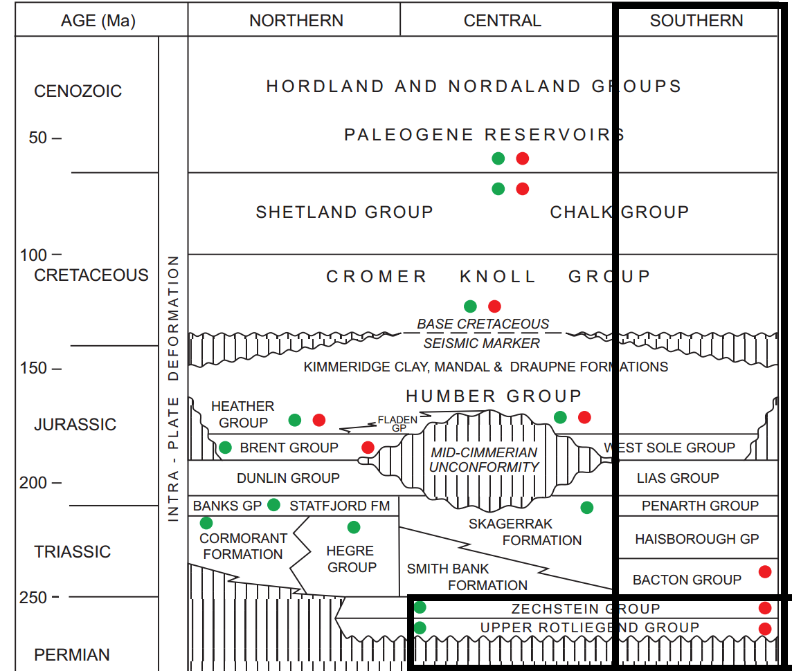
Thick deposits of halite (rock salt), gypsum, and anhydrite occur at multiple levels throughout the geologic column. These minerals form by the evaporation of saline water — a process that requires prolonged exposure to arid conditions, not submersion under a global ocean.11 The Messinian Salinity Crisis of the late Miocene produced a Mediterranean evaporite sequence up to 3 kilometers thick, requiring the repeated evaporation and refilling of the Mediterranean basin over hundreds of thousands of years.11 The Permian Zechstein evaporites of northern Europe and the Silurian Salina Group of the Michigan Basin present similar problems: salt deposits kilometers thick that demand prolonged evaporation under arid conditions, sandwiched between strata that flood geology attributes to continuous underwater deposition.11, 8
Paleosols
Paleosols are ancient soils preserved in the rock record. They exhibit the same diagnostic features as modern soils: root traces, clay mineral weathering profiles, soil horizons (A, B, C), bioturbation structures, and pedogenic carbonate nodules.12 Paleosols occur at dozens of levels throughout the Paleozoic, Mesozoic, and Cenozoic — including within sequences that flood geologists attribute to continuous underwater deposition. Soil formation requires a stable land surface with vegetation, weathering, and biological activity over centuries to millennia. The presence of mature paleosols between marine strata is incompatible with a scenario of continuous submersion.9, 12
In-place coral reefs
Fossil coral reefs occur at multiple horizons in the geologic column, from the Ordovician through the Quaternary. Many of these are demonstrably in growth position: corals are oriented vertically with intact bases attached to underlying substrate, associated organisms (bivalves, crinoids, bryozoans) are in life position, and the reef framework shows the same zonation patterns seen in modern reefs.13 Modern coral reefs grow at rates of 1 to 10 millimeters per year. The Permian Capitan Reef of west Texas and New Mexico is over 600 meters thick, requiring hundreds of thousands of years of growth at maximum observed rates.13, 8 These reefs cannot be explained as debris rafted into position by floodwaters, because their internal structure preserves the growth architecture of organisms that lived and died in place over long periods.
Radiometric dating
Multiple independent radiometric dating methods — uranium-lead, potassium-argon, rubidium-strontium, samarium-neodymium, and others — consistently date the oldest rocks on Earth to approximately 4.0 billion years and the oldest minerals (detrital zircons from the Jack Hills of Western Australia) to 4.4 billion years.14, 20 Interbedded volcanic ash layers (bentonites) throughout the sedimentary column provide direct radiometric ages for the strata that contain them. These dates are mutually consistent across different decay systems with different parent isotopes, different decay rates, and different chemical behaviors — a pattern that is expected if the dates reflect actual elapsed time and that would require an extraordinary coincidence if all decay rates had been somehow accelerated during a single year.14, 21
Flood geology proponents have proposed that radioactive decay rates were accelerated by orders of magnitude during the flood year. However, accelerated decay sufficient to compress 4.5 billion years into one year would release enough heat to melt the Earth’s crust and raise its temperature by tens of thousands of degrees — a problem acknowledged by young-earth researchers themselves in the RATE (Radioisotopes and the Age of the Earth) project.14, 8
Fossil sorting
The claim that fossils are sorted by hydrodynamic properties rather than by evolutionary history fails on multiple grounds.15
First, the predicted hydrodynamic order does not match the observed order. Flood geology predicts that heavy, dense organisms should be at the bottom and light, buoyant ones at the top. In reality, massive dinosaurs (some weighing over 50 tonnes) are found in Mesozoic strata above marine invertebrates, while tiny foraminifera — single-celled organisms less than a millimeter in diameter — are found at every level from the Cambrian to the present. Dense-shelled ammonites are absent from Cenozoic rocks despite being heavier than many organisms found higher in the column.15, 8
Second, the fossil record shows systematic patterns that hydrodynamic sorting cannot explain. Pollen grains — microscopically small and easily transported by water — show a clear evolutionary succession: no angiosperm (flowering plant) pollen appears before the Cretaceous, despite angiosperms producing some of the lightest pollen of any plant group. If hydrodynamic sorting controlled fossil distribution, angiosperm pollen should be found at the top of the column, but it should also be scattered throughout lower strata by turbulence. Its consistent absence from pre-Cretaceous rocks reflects evolutionary origination, not water sorting.15
Third, the order of fossils is consistent worldwide. The same sequence of fossil assemblages — trilobites before ammonites, ammonites before modern bony fish, dinosaurs before large mammals — is found on every continent, regardless of local depositional environment. A global flood scouring diverse ecosystems simultaneously would not produce the same vertical ordering in Australia, Africa, North America, and Europe.15, 18
The Grand Canyon
Flood geologists frequently cite the Grand Canyon as evidence of rapid, catastrophic erosion. However, the Canyon’s own stratigraphy contradicts a flood origin.19
The Canyon exposes nearly 2 billion years of Earth history in its walls. The lowermost Vishnu Schist is a metamorphic basement complex dated to approximately 1.7 billion years. Above it, the Grand Canyon Supergroup (tilted Proterozoic sediments) is separated from the overlying horizontal Paleozoic strata by the Great Unconformity, representing hundreds of millions of years of erosion. The Paleozoic sequence itself contains alternating marine and terrestrial formations: the Redwall Limestone (marine), the Supai Group (floodplain and dune deposits with mudcracks and reptile tracks), the Coconino Sandstone (aeolian cross-bedded dunes with fossil trackways), and the Kaibab Limestone (marine).19, 23
The alternation between marine and terrestrial deposits, the presence of desert dune cross-bedding within the sequence, fossil trackways of animals walking on dry sand, and multiple unconformities within the Canyon walls are collectively incompatible with deposition under a single continuous flood.19 The Coconino Sandstone alone contains thousands of trackways made by small reptiles walking uphill on dry sand dunes — features impossible to form underwater.19, 8
As for the carving of the Canyon itself, the Colorado River’s downcutting history is recorded in river terraces at progressively higher elevations, in basalt flows that once dammed the river and are now radiometrically dated, and in the drainage patterns of tributary canyons — all consistent with millions of years of incremental erosion, not a single catastrophic event.19
The water budget problem
A global flood covering all land surfaces, including the highest mountains, requires an enormous volume of water beyond what currently exists on Earth. The total volume of water in all of Earth’s oceans is approximately 1.335 billion cubic kilometers. To cover Mount Everest (8,849 meters above sea level), an additional 4.5 billion cubic kilometers of water would be needed — more than three times the current ocean volume.8
Flood geologists sometimes propose that pre-flood mountains were lower and that current mountain ranges were uplifted during or after the flood. This ad hoc adjustment creates its own problems: the rapid uplift of the Himalayas, Andes, Rockies, and Alps during or immediately after a single year would release enormous tectonic energy, generating heat and seismic activity far exceeding anything compatible with the survival of humans and animals on the Ark. Additionally, the thick sedimentary sequences in these mountain ranges — marine limestones in the Himalayas, for instance — predate the proposed flood by hundreds of millions of years based on their fossil content and radiometric dates.8, 14
A related problem is where the water went after the flood. If additional water was introduced from a “vapor canopy” or subterranean reservoirs (as some flood geologists propose), it must have been removed within a short period. Evaporation into space is thermodynamically implausible at the required rate, and absorption into the mantle would require geological processes operating over millions of years, not months.8
The heat dissipation problem
Several processes invoked by flood geology would generate catastrophic quantities of heat. The condensation of a vapor canopy sufficient to contribute significantly to global flooding would release latent heat capable of raising atmospheric temperatures to hundreds of degrees Celsius — sterilizing all life on the surface.8 Rapid tectonic plate movement (proposed by some flood geologists under the label “catastrophic plate tectonics”) would generate frictional and volcanic heat far exceeding the capacity of any known mechanism to dissipate it within a year. The accelerated radioactive decay proposed by the RATE project would, as noted above, release enough energy to melt the crust.14, 8
These are not minor quantitative objections. Each heat source alone would produce temperatures incompatible with the survival of any organism on Earth. Combined, they represent a fundamental thermodynamic barrier to the flood geology model that its proponents have acknowledged but not resolved.8
Biogeographic problems
If all terrestrial animals were reduced to a single breeding population aboard an ark in the ancient Near East, the subsequent distribution of species across the globe requires explanation. The biogeographic evidence presents severe difficulties for the flood model.16, 18
Australia’s fauna is dominated by marsupials and monotremes found nowhere else. Under the flood model, these animals disembarked in the Near East and migrated to Australia — crossing thousands of kilometers of terrain including ocean barriers — without leaving any fossil trace along the route and without being outcompeted by placental mammals traveling the same paths.16 The same problem applies to lemurs (found only in Madagascar), sloths and armadillos (South America), and the unique avifauna of New Zealand and Hawaii. In each case, the endemic fauna matches what would be expected from millions of years of isolated evolution on island or continental landmasses, not from recent dispersal from a single point of origin.16, 18
Island biogeography compounds the problem. Oceanic islands formed by volcanism (Hawaii, the Galápagos, the Canary Islands) have native species closely related to those on the nearest continent, with diversity proportional to island age and distance from the mainland. This pattern is predicted by evolutionary dispersal and speciation but is inexplicable under a model where all species dispersed simultaneously from a single location a few thousand years ago.16
Genetic bottleneck problems
If all species were reduced to a single pair (or seven pairs for “clean” animals, per Genesis 7:2) approximately 4,500 years ago, the genetic consequences should be detectable in every species on Earth. A population bottleneck that severe would dramatically reduce genetic diversity, producing a signature visible in the genomes of all living organisms.17, 22
No such signature exists. Human populations alone carry levels of genetic diversity that require an effective population size of approximately 10,000 individuals maintained over hundreds of thousands of years, based on coalescence analysis of mitochondrial DNA, Y-chromosome markers, and genome-wide polymorphism data.17 The allelic diversity at the major histocompatibility complex (MHC) loci in humans includes lineages that diverged millions of years ago — lineages that could not have passed through a bottleneck of eight individuals 4,500 years ago without being lost.17, 22
The same pattern holds across the animal kingdom. Cheetahs, which did experience a genuine population bottleneck approximately 10,000 years ago, show dramatically reduced genetic diversity compared to other large cats — providing a real-world example of what a bottleneck looks like in genomic data. No comparable reduction is found in the vast majority of species, as would be expected if all had been reduced to minimal populations simultaneously.22
Coal and petroleum formation
The claim that coal and petroleum formed rapidly during the flood conflicts with the chemistry and structure of these deposits. Coal seams frequently contain in-situ root systems (stigmarian roots) penetrating the underlying seat earth, demonstrating that the plants grew where the coal now sits rather than being rafted into position by floodwaters. Multiple coal seams are commonly separated by marine limestone or shale, indicating repeated cycles of swamp growth, submergence, and marine deposition — a pattern incompatible with a single event.8
Petroleum formation requires the slow thermal maturation (catagenesis) of kerogen in organic-rich source rocks at temperatures of 60–160°C over millions of years. The kinetics of this process are well-understood from laboratory experiments and field observations. While high temperatures can accelerate organic maturation in laboratory settings, the volumes of petroleum found in sedimentary basins require source rocks that have been buried at appropriate depths for geologically long periods, not flash-heated during a single catastrophic year.8, 11
Scientific consensus
Flood geology is rejected by the scientific community, including geologists who are personally religious. The National Academy of Sciences, the Geological Society of America, the American Geophysical Union, and every major professional geological organization have issued statements affirming that the Earth is approximately 4.54 billion years old and that its geological features are the product of processes operating over deep time, not a single catastrophic flood.18, 14
The historical trajectory of the idea is instructive. Flood geology was the default geological framework in the seventeenth and eighteenth centuries, when it was held by virtually all European natural philosophers. It was abandoned in the early nineteenth century not because of anti-religious bias but because Christian geologists — Buckland, Sedgwick, Lyell, and their contemporaries — found it incompatible with the evidence of the rocks.4, 5, 6, 7 Its twentieth-century revival was driven not by new geological evidence but by theological commitments to biblical literalism, particularly within the Seventh-day Adventist tradition and the broader young-earth creationist movement that followed the publication of The Genesis Flood.4
The evidence against flood geology is not a single argument but a convergence of independent lines of inquiry — stratigraphy, radiometric dating, paleontology, biogeography, genetics, thermodynamics, and sedimentology — each of which independently falsifies the flood model. This convergence is what makes the scientific case definitive: explaining away any one line of evidence still leaves all the others intact.8, 18