Overview
- Cratons are the ancient, stable cores of continents — regions of thick, cold lithosphere that have remained tectonically quiescent for billions of years, with some preserving rocks dating to the Eoarchean era more than 3.6 billion years ago.
- Each craton possesses a deep lithospheric keel extending 200–350 kilometres into the mantle, composed of chemically depleted, buoyant peridotite that insulates the craton from mantle convection and gives it long-term stability — a property that also creates the pressure-temperature conditions necessary for diamond formation.
- Shields are the exposed portions of cratons where Precambrian crystalline basement crops out at the surface, while platforms are the parts buried beneath thin veneers of younger sedimentary rock; together, shields and platforms constitute the stable continental nuclei around which younger orogenic belts have been accreted through successive Wilson cycles.
Cratons are the ancient, stable cores of Earth's continents — regions of extraordinarily thick, cold, and rigid lithosphere that have remained tectonically quiescent for billions of years while younger, more dynamic geological provinces have been assembled and dismembered around them. The term derives from the Greek kratos, meaning strength, and aptly describes rocks that have endured since the Archean eon while the surrounding crust has been repeatedly deformed, metamorphosed, rifted, and recycled by plate tectonic processes.1, 6 A craton's surface expression is divided into two parts: the shield, where Precambrian crystalline basement — granites, gneisses, greenstone belts — is exposed at the surface, and the platform, where the same ancient basement is buried beneath a thin, essentially undeformed veneer of Phanerozoic sedimentary rocks. Together, shields and platforms form the nuclei around which continents have grown through the progressive accretion of younger orogenic belts over geological time.6, 18
Defining cratons: stability and antiquity
The defining characteristic of a craton is its long-term tectonic stability. While most of Earth's continental surface has been affected by significant deformation at some point in the Phanerozoic eon (the last 538 million years), cratonic interiors have remained essentially undeformed since the Precambrian — some for more than three billion years.1, 6 This stability is expressed in several observable ways: cratons lack significant seismicity, they display subdued topography (typically low-lying plains or gentle plateaus), their sedimentary cover is thin and flat-lying, and they are characterised by low heat flow values — typically 40–50 milliwatts per square metre, roughly half the global continental average.3
The antiquity of cratons is established by radiometric dating of the crystalline basement rocks exposed in their shield areas. The oldest terrestrial materials known — the 4.4-billion-year-old Jack Hills zircons from the Yilgarn Craton of Western Australia — are hosted in Archean metasedimentary rocks within a cratonic terrane.6 The Acasta Gneiss in the Slave Craton of northwestern Canada, dated at approximately 4.03 billion years, represents the oldest known intact crustal rock.6 Most cratonic basement, however, formed during the major period of Archean crustal growth between 3.5 and 2.5 billion years ago, when the processes of crust formation — possibly involving both plate tectonic and non-plate tectonic mechanisms — were operating under thermal conditions significantly different from those of the modern Earth.18
A distinction is sometimes drawn between Archean cratons, which formed before 2.5 billion years ago and possess the thickest and most chemically depleted lithospheric keels, and Proterozoic cratons, which formed between 2.5 and 1.0 billion years ago and typically have somewhat thinner lithospheric roots.4 Both share the fundamental property of long-term stability, but the Archean cratons are generally the most robust: they have survived repeated episodes of mantle upwelling, continental rifting, and collisional tectonics that have destroyed or reworked the margins of many Proterozoic provinces.
Lithospheric keels and the tectosphere
The remarkable stability of cratons was first explained in quantitative geophysical terms by Thomas H. Jordan in a landmark 1978 paper. Jordan proposed that each craton is underlain by a thick root of cold, chemically depleted lithospheric mantle — a "tectosphere" or lithospheric keel — that extends to depths of 200–350 kilometres, far deeper than the lithospheric roots beneath younger continental or oceanic regions.1 This keel, Jordan argued, is intrinsically buoyant because the chemical depletion it has undergone (the extraction of basaltic melt during the Archean) has reduced its density relative to normal fertile mantle. The buoyancy of the depleted keel compensates for its thermal contraction (cold rock is denser), producing a condition of near-neutral buoyancy that Jordan termed the "isopycnic hypothesis" — the idea that the cratonic lithosphere is close to the same density as the surrounding asthenosphere at every depth, preventing it from being entrained and destroyed by mantle convection.1
Seismic tomography has confirmed and refined Jordan's model. High-resolution body-wave and surface-wave tomographic studies consistently image fast seismic velocities extending to 200–300 kilometres depth beneath Archean cratons, indicative of cold, rigid material that contrasts sharply with the slower, warmer asthenosphere at equivalent depths beneath younger tectonic provinces.13 The Kaapvaal Craton in southern Africa and the Slave Craton in Canada have been particularly well imaged, revealing keels with P-wave velocity anomalies of +1 to +3 per cent relative to global reference models, extending to depths of at least 250 kilometres.13
The chemical composition of the cratonic lithospheric mantle is constrained by xenoliths — fragments of mantle rock brought rapidly to the surface by kimberlite and lamproite magmas. These xenoliths, which include harzburgite, lherzolite, and eclogite, show that the cratonic mantle is strongly depleted in the elements (iron, aluminium, calcium) that partition preferentially into basaltic melt. The residual composition — enriched in magnesium-rich olivine and orthopyroxene, with low aluminium and calcium — is both less dense and more refractory (higher melting point) than fertile asthenospheric mantle, contributing to the long-term chemical and mechanical isolation of the keel from the convecting mantle below.2, 4 The rheological properties of this depleted, dehydrated mantle are also important: laboratory experiments show that the removal of water during melt extraction increases the viscosity of olivine by one to two orders of magnitude, rendering the cratonic keel far more resistant to deformation than normal mantle.14
Diamond stability fields and kimberlite pipes
The deep, cold lithospheric keels beneath cratons create a unique geochemical environment that is directly responsible for the formation and preservation of natural diamonds. Diamond is the high-pressure polymorph of carbon, stable only at pressures exceeding approximately 4.5 gigapascals and at temperatures that, crucially, must remain below the mantle geotherm of the surrounding asthenosphere to prevent graphitisation.7 These conditions — high pressure, relatively low temperature — are found within the thick lithospheric keels of Archean cratons at depths of roughly 150–250 kilometres, a zone termed the "diamond stability field."7, 4
Diamonds form over geological timescales within the cratonic mantle keel, with inclusion studies yielding ages that range from the Archean (more than 3 billion years) to the Proterozoic and, rarely, the Phanerozoic.7 The carbon source is debated but likely includes both primordial mantle carbon and carbon recycled from the surface through subduction of organic-rich sediments and carbonated oceanic crust. The mineral inclusions trapped within diamonds at the time of their growth — including olivine, garnet, pyroxene, and, in rare cases, minerals indicative of lower-mantle pressures — provide invaluable windows into the composition and conditions of the deep lithosphere at the time of diamond formation.7
Diamonds reach the surface through kimberlite eruptions — explosive volcanic events in which deep-sourced, volatile-rich magmas ascend from depths of 150 kilometres or more at velocities sufficient to transport their diamond cargo to the surface before the reduction in pressure can convert the diamonds to graphite.12 Kimberlite pipes are found almost exclusively within or at the margins of Archean cratons, because only these regions possess lithospheric keels thick enough to reach the diamond stability field. The global distribution of economically significant diamond deposits — concentrated in southern Africa (Kaapvaal Craton), Siberia (Siberian Craton), Canada (Slave and Superior cratons), western Australia (Yilgarn and Kimberley cratons), and India (Dharwar Craton) — maps directly onto the distribution of Archean cratonic lithosphere.7, 12
Shields versus platforms
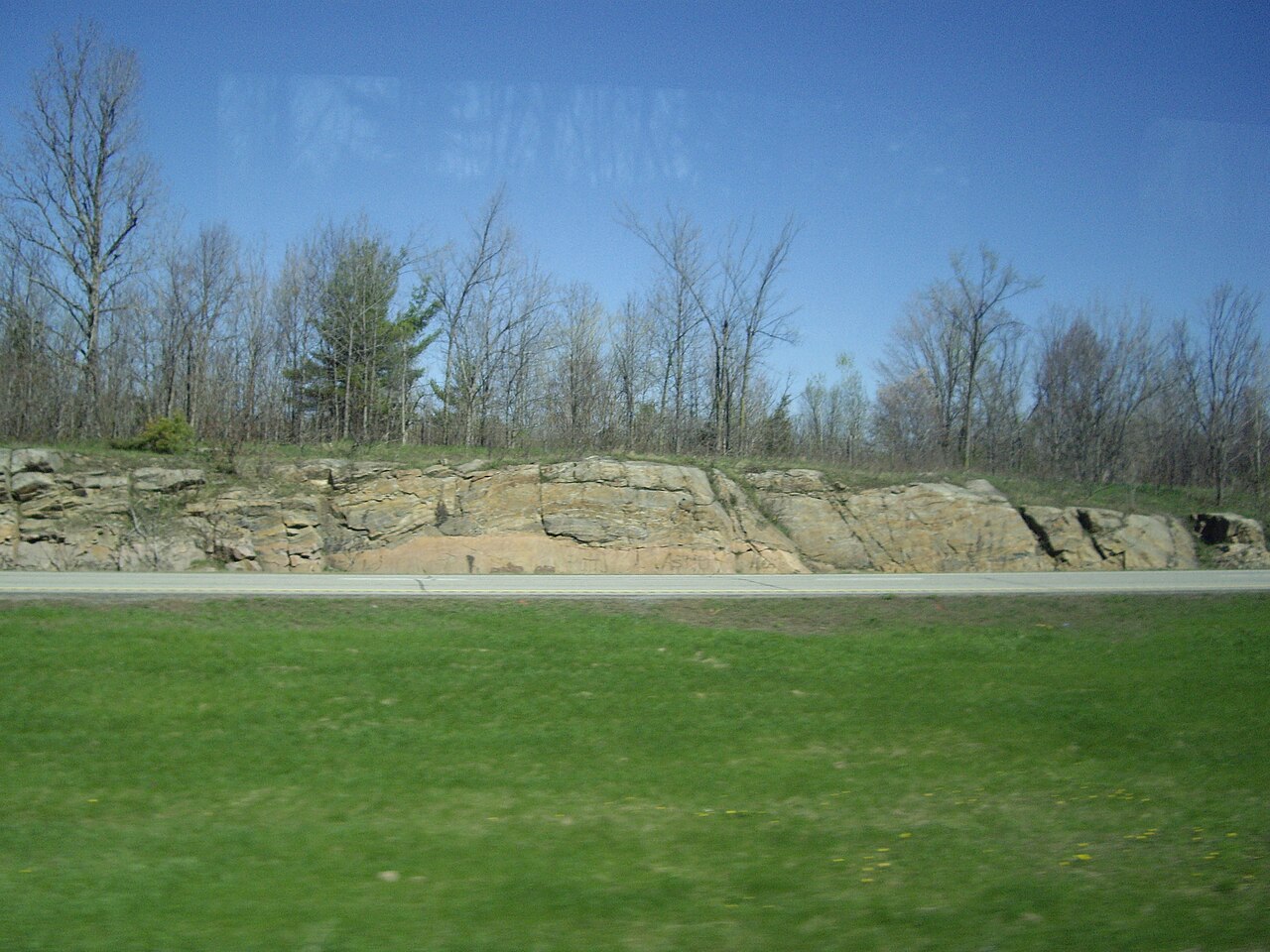
The surface expression of a craton is divided into two physiographic domains that differ not in basement age or composition but in the presence or absence of sedimentary cover. The shield is the portion of the craton where Precambrian crystalline basement — granites, migmatitic gneisses, greenstone belt assemblages, high-grade metamorphic complexes — is exposed at the surface, stripped of any younger cover by billions of years of erosion.6 The Canadian Shield, occupying much of eastern and central Canada, is the largest exposed shield area on Earth, comprising roughly 8 million square kilometres of Archean and Proterozoic basement. Other major shields include the Fennoscandian (Baltic) Shield of Scandinavia and Finland, the Guiana and Brazilian shields of South America, the West African and Congo shields, the Indian (Dharwar) Shield, the Australian shields, and the Angaran Shield of Siberia.6
The platform is the complementary portion of the craton where the same crystalline basement is buried beneath a veneer of Phanerozoic sedimentary rocks — typically shallow-marine limestones, sandstones, and shales deposited during periodic transgressions of epicontinental seas across the low-lying cratonic interior.17 This sedimentary cover is generally thin (a few hundred metres to two or three kilometres) and remarkably flat-lying, reflecting the tectonic quiescence of the underlying basement. The interior lowlands of North America — the Great Plains and the midcontinent region extending from the Appalachian Basin to the Rocky Mountains — constitute the platform portion of the North American Craton, overlying the same Precambrian basement that is exposed in the Canadian Shield to the north.8
The distinction between shield and platform is purely one of erosion and sedimentation history, not of fundamental geological character. The boundary between them is a mapped contact — the edge of the Phanerozoic sedimentary cover — that shifts over geological time as the relative balance between erosion and deposition changes. During sea-level highstands, the platform area expands as epicontinental seas flood the low-relief cratonic surface; during lowstands, the shield expands as the sedimentary cover is eroded back toward the margins. The sedimentary sequences preserved on cratonic platforms are of considerable economic importance, hosting hydrocarbon reservoirs, potash deposits, and freshwater aquifers.17
Major cratons of the world
The Kaapvaal Craton of southern Africa is one of the oldest and best-studied cratons on Earth. Its oldest components — the Barberton Greenstone Belt and associated tonalite-trondhjemite-granodiorite gneisses — formed between 3.55 and 3.2 billion years ago, recording some of the earliest preserved crustal growth on the planet.5 The Kaapvaal Craton stabilised by approximately 3.0 billion years ago and has remained a coherent tectonic block since, accumulating thin platformal sedimentary sequences including the Witwatersrand Supergroup (host to the world's largest gold deposits) and the Transvaal Supergroup. Its lithospheric keel, imaged seismically to depths exceeding 250 kilometres, has been sampled extensively by kimberlite-hosted xenoliths, making the Kaapvaal the type example for studies of cratonic lithospheric mantle composition.2, 13
The Superior Craton, the largest component of the Canadian Shield, covers approximately 1.6 million square kilometres and is composed of a series of east-west-trending granite-greenstone and metasedimentary subprovinces that were assembled between approximately 2.75 and 2.65 billion years ago during a series of Neoarchean collisional events.8 The Superior Craton contains some of the world's richest mineral deposits, including the gold camps of the Abitibi greenstone belt and the nickel-copper-platinum group element deposits of the Sudbury structure. Its assembly provides one of the clearest records of Archean tectonic processes, with evidence for subduction, arc accretion, and continental collision that closely parallels modern plate tectonic mechanisms.8, 18
The Pilbara Craton of Western Australia is a relatively small but scientifically important craton preserving some of the earliest evidence of life on Earth. Its oldest rocks, the 3.52-billion-year-old Coonterunah Subgroup, include pillow basalts and cherts that host putative microfossils and stromatolites.9 The Pilbara is characterised by a distinctive dome-and-basin structural pattern in which oval granite-gneiss domes are separated by intervening synclines of greenstone belt supracrustal rocks — a geometry that has been interpreted both as the product of gravity-driven vertical tectonics (sagduction) and as the result of horizontal shortening and fold interference, reflecting ongoing debate about the relative importance of vertical and horizontal tectonic processes in the Archean.9
The Dharwar Craton of peninsular India comprises two principal subprovinces: the Eastern Dharwar Craton and the Western Dharwar Craton, separated by the Chitradurga shear zone. The Western Dharwar Craton preserves Palaeoarchean gneisses and greenstone belts with ages exceeding 3.3 billion years, while the Eastern Dharwar Craton is dominated by Neoarchean granites and greenstones formed around 2.7–2.5 billion years ago.15 Palaeomagnetic and geological evidence indicates that the Dharwar Craton was contiguous with the Kaapvaal Craton of southern Africa during the Archean, forming part of the proposed Vaalbara supercraton — one of the earliest continental assemblages in Earth's history.15, 16
Selected major Archean cratons4, 6
| Craton | Location | Oldest rocks (Ga) | Approx. area (106 km2) | Keel depth (km) |
|---|---|---|---|---|
| Kaapvaal | Southern Africa | 3.55 | 1.2 | 250–300 |
| Superior | Canada | 3.0 | 1.6 | 200–250 |
| Pilbara | Western Australia | 3.52 | 0.6 | 200–250 |
| Dharwar | India | 3.35 | 0.35 | 200–250 |
| Slave | Canada | 4.03 | 0.3 | 250–300 |
| Siberian | Russia | 3.0 | 4.0 | 250–350 |
| Zimbabwe | Southern Africa | 3.5 | 0.3 | 200–250 |
| Yilgarn | Western Australia | 3.73 | 0.66 | 200–250 |
Craton destruction and the North China example
Although cratons are defined by their long-term stability, they are not indestructible. The most dramatic documented example of craton destruction is the North China Craton, which possessed a thick, cold lithospheric keel throughout the Precambrian and into the Palaeozoic but lost the deeper portion of this keel during the Mesozoic and Cenozoic eras.10 The evidence for this destruction is multifaceted. Kimberlite-hosted xenoliths erupted during the Ordovician (approximately 470 million years ago) sample a thick, cold, depleted lithospheric mantle extending to at least 200 kilometres — a typical Archean keel. Cenozoic basalt-hosted xenoliths from the same region, however, sample a thin, hot, fertile mantle that resembles oceanic or off-craton lithosphere rather than typical cratonic material.10 The keel was removed or thermally and chemically overprinted over an interval of roughly 200 million years.
The mechanism of the North China Craton's destruction remains actively debated but is generally attributed to some combination of processes related to the Mesozoic subduction of the Pacific plate beneath eastern Asia. Proposed mechanisms include thermal erosion of the keel by anomalously hot mantle, mechanical removal by subduction-driven convective instabilities, and chemical refertilisation by infiltrating melts and fluids derived from the subducting slab.10 The eastern portion of the craton, which is closer to the subduction zone, has lost its keel almost entirely, while the western portion retains thicker, colder lithosphere — a spatial pattern consistent with the subduction-related origin of the destruction.
The case of the North China Craton has important implications for understanding cratonic stability globally. It demonstrates that the conditions that ordinarily preserve cratons — thick, depleted, dehydrated keels with high viscosity — can be overcome by sufficiently intense tectonic forcing. Other cratons may have undergone partial destruction in the geological past without leaving a record as clear as the North China example. The Wyoming Craton in western North America, for instance, has anomalously thin lithosphere for an Archean craton, which has been attributed to Cenozoic modification by the Yellowstone hotspot and Laramide flat-slab subduction.3 Understanding the conditions under which cratons can be destroyed is essential for reconstructing the long-term evolution of the continents and for explaining the heterogeneous seismic velocity structure of the subcontinental mantle.
Cratons and the Wilson cycle
Cratons serve as the stable nuclei around which continents are built and rebuilt through the Wilson cycle — the recurring process of ocean basin opening and closing driven by plate tectonics.11 Each Wilson cycle involves the rifting of a continent to create a new ocean, the growth of that ocean by seafloor spreading, the eventual initiation of subduction and ocean closure, and the collision of the converging continents to form an orogenic belt. The sutured product of this collision then becomes part of the enlarged continent, surrounding the original cratonic core with a new ring of accreted material. Over multiple Wilson cycles spanning billions of years, this progressive accretion has built the continents from their Archean cratonic nuclei outward, adding successively younger Proterozoic and Phanerozoic orogenic belts at the margins.11, 18
The North American continent illustrates this growth pattern clearly. The Archean cratons of the interior — the Superior, Slave, Rae, Hearne, and Wyoming provinces — were assembled during Neoarchean collisional events between 2.7 and 2.6 billion years ago. These were then surrounded by Palaeoproterozoic orogenic belts (the Trans-Hudson, Penokean, and Wopmay orogens) during a major episode of continental assembly around 1.8 billion years ago, forming the protocontinent Laurentia. Successive accretionary events added the Mesoproterozoic Grenville Province, the Palaeozoic Appalachian and Ouachita orogens, and the Mesozoic-Cenozoic Cordilleran orogen, each contributing new material at the continental margins while the Archean cratonic core remained undeformed in the interior.8, 6
The assembly and dispersal of supercontinents — Vaalbara, Kenorland, Columbia (Nuna), Rodinia, Pannotia, and Pangaea — represent the global-scale expression of the Wilson cycle. Each supercontinent assembled as the world's cratons were brought together by convergent plate motions and then dispersed as rifting fragmented the supercontinent into smaller continental blocks, each carrying its cratonic core. Palaeomagnetic reconstructions of these ancient supercontinents depend critically on the identification and correlation of cratonic blocks, because the stable interiors of cratons are the most reliable recorders of palaeopole positions.16
Cratonic sedimentary basins
The stable, low-relief surfaces of cratonic platforms provide ideal settings for the accumulation of broad, shallow sedimentary basins that preserve long, relatively complete stratigraphic records of Earth's surface conditions. Intracratonic basins — circular to oval depressions within the cratonic interior, filled with shallow-marine and terrestrial sedimentary sequences — are among the largest and longest-lived sedimentary depocentres on Earth.17
The Michigan, Illinois, and Williston basins of the North American midcontinent are classic examples of intracratonic basins. The Michigan Basin, a nearly circular depression with a diameter of roughly 400 kilometres, contains a sedimentary fill of Palaeozoic carbonates, evaporites, and clastics up to 5 kilometres thick, deposited over an interval spanning the Cambrian to the Pennsylvanian periods — roughly 300 million years of essentially continuous subsidence within the stable cratonic interior.17 The Congo Basin in central Africa, the Paraná Basin of South America, and the great intracratonic basins of the Siberian platform display similar geometries and histories.
The subsidence mechanisms responsible for intracratonic basins remain incompletely understood. Unlike basins at plate margins, which subside in response to clearly identifiable tectonic loading or extension, intracratonic basins form in the absence of any obvious plate boundary forcing. Proposed mechanisms include thermal contraction following episodes of localised lithospheric heating, dynamic topography driven by mantle convection beneath the craton, phase changes in the lower crust (such as the transformation of basalt to denser eclogite), and slow gravitational adjustment to inherited density anomalies in the lithosphere.17 The long timescales of intracratonic basin subsidence — typically hundreds of millions of years — suggest that whatever drives them operates at the slow, steady pace of deep lithospheric and mantle processes rather than the more episodic tempo of plate boundary tectonics.
The economic importance of cratonic sedimentary basins is considerable. The Williston Basin hosts the Bakken Formation, one of the largest unconventional oil plays in North America. The Siberian Platform contains vast reserves of natural gas, diamonds (in kimberlite pipes that punch through the sedimentary cover), and the enormous Norilsk nickel-copper-palladium deposits associated with the Siberian Traps flood basalts. The Witwatersrand Basin of the Kaapvaal Craton's platform portion has yielded more gold than any other single geological unit in history.5, 17 Cratonic basins thus represent not only archives of Earth's geological history but also repositories of mineral and energy resources of global significance.
References
Diamond formation in the deep Earth: the record of mineral inclusions and their distribution in relation to mantle dehydration zones
Seismic evidence for a thick and chemically distinct mantle keel beneath cratonic lithosphere
Thermal structure and rheology of the upper mantle: implications for craton stability
Precambrian supercontinents, glaciations, atmospheric oxygenation, metazoan evolution and an impact that may have changed the second half of Earth history