Overview
- Rivers transport approximately 20 billion tonnes of sediment to the oceans each year under natural conditions, sculpting landscapes through erosion, transport, and deposition processes governed by the relationship between flow velocity, stream power, and grain size as described by the Hjulström curve and Shields parameter.
- Channel patterns — straight, meandering, braided, and anabranching — arise from the interaction of discharge, slope, sediment load, and bank resistance, with Leopold and Wolman's 1957 threshold showing that at a given discharge, braided channels form at steeper slopes than meandering ones.
- Fluvial systems shape landforms at every scale, from centimetre-scale ripples and decimetre-scale dunes on the channel bed to kilometre-scale floodplains, alluvial fans, and deltas, while also exerting first-order control on the global carbon and nutrient cycles through the chemical weathering and transport of dissolved loads totalling roughly 3.9 billion tonnes per year.
Fluvial geomorphology is the study of landforms and processes created by flowing water in rivers and streams. Rivers are among the most powerful agents of landscape change on Earth, eroding bedrock and sediment from upland source areas, transporting that material downstream, and depositing it in floodplains, deltas, and ocean basins.4, 10 Under natural conditions, the world's rivers deliver approximately 20 billion tonnes of sediment and 3.9 billion tonnes of dissolved material to the oceans each year, figures that make fluvial processes the dominant mechanism of continental denudation in non-glaciated regions.5, 13, 21 The discipline draws on fluid mechanics, sediment transport theory, and field geomorphology to understand how channels adjust their shape and pattern in response to the water and sediment supplied to them — an interplay that determines everything from the width and depth of a single reach to the architecture of entire drainage basins.4, 6
The foundations of fluvial geomorphology were laid in the mid-twentieth century by researchers at the United States Geological Survey, most notably Luna Leopold, who with Thomas Maddock established the concept of hydraulic geometry in 1953 and with M. Gordon Wolman published the first quantitative classification of channel patterns in 1957.1, 2 Stanley Schumm subsequently developed the concept of the fluvial system, in which a drainage basin is divided into three zones — production (erosion), transfer (transport), and deposition — each dominated by different processes and producing distinct landforms.6 These frameworks remain central to both research and applied river management, informing flood risk assessment, dam design, habitat restoration, and responses to climate change.7, 19
Flow hydraulics and the river channel
The behaviour of water flowing in an open channel is governed by the interplay of gravity, friction, and inertia. Gravity drives the flow downslope along the channel gradient, while friction with the bed and banks dissipates energy and retards flow velocity. The balance between these forces determines two critical dimensionless numbers: the Reynolds number, which distinguishes laminar from turbulent flow, and the Froude number, which separates subcritical (tranquil) from supercritical (rapid) flow.4, 10 Nearly all natural river flows are fully turbulent and subcritical, with Froude numbers less than one, although supercritical conditions can occur locally over rapids, waterfalls, and steep mountain torrents.4
The velocity of flow in a channel is not uniform but varies systematically with position. Maximum velocity occurs just below the water surface near the centre of the channel (shifted slightly toward the outside bank in meander bends), while velocity approaches zero at the bed and bank surfaces due to the no-slip condition. This velocity distribution generates shear stress on the channel boundary, and it is this bed shear stress (τ0) that performs the geomorphic work of entraining and transporting sediment.4, 10 Bed shear stress increases with both depth and slope according to the depth-slope product τ0 = ρgRS, where ρ is water density, g is gravitational acceleration, R is the hydraulic radius, and S is the energy slope.4
Stream power, defined as the rate of energy expenditure per unit length of channel (Ω = ρgQS, where Q is discharge), provides an integrated measure of a river's capacity to erode and transport sediment. Specific stream power (ω = Ω/w, where w is channel width) is particularly useful for comparing the erosive potential of channels of different sizes and is a key variable in predicting channel pattern, bank erosion rates, and sediment transport capacity.4, 7
Sediment entrainment and transport
The entrainment of sediment from the channel bed requires that the fluid forces acting on a grain exceed the resisting forces of gravity and friction. The Swedish geographer Filip Hjulström was the first to systematically describe this relationship in his 1935 doctoral thesis, producing the curve that bears his name. The Hjulström curve plots the critical flow velocity required to erode, transport, and deposit sediment as a function of grain size, revealing a counterintuitive result: fine-grained cohesive sediments (clay and silt) require higher velocities to erode than medium sand, because electrochemical bonds between clay particles create cohesive strength that must be overcome in addition to particle weight.3, 7 Medium sand grains (approximately 0.1–0.5 mm) are the most easily eroded, requiring the lowest critical velocity, while both finer and coarser particles demand progressively more energetic flows to initiate movement.3
A more physically rigorous approach to sediment entrainment was developed by Albert Shields in 1936, who expressed the threshold of motion in terms of a dimensionless shear stress (the Shields parameter, θcr) that accounts for both fluid and sediment properties. The critical Shields parameter for the initiation of motion on a flat bed of uniform, non-cohesive sediment is approximately 0.045–0.060, though field measurements show considerable scatter due to variations in grain packing, bed slope, and turbulent fluctuations.8, 10
Once sediment is in motion, it travels by one of three modes. Bed load consists of coarse particles that roll, slide, or saltate (bounce) along the bed surface, remaining in near-continuous contact with it. Suspended load comprises finer particles held aloft by turbulent eddies, their concentration decreasing upward from the bed according to the Rouse profile. Dissolved load consists of ions produced by chemical weathering and carried invisibly in solution.4, 7 The relative proportions of these modes vary enormously among rivers: steep, coarse-bedded mountain streams carry most of their sediment as bed load, while large, low-gradient rivers such as the Mississippi or Amazon transport the overwhelming majority of their load in suspension.6, 5
The classic bed-load transport equation of Meyer-Peter and Müller (1948) relates the dimensionless transport rate to the excess shear stress above the critical threshold, raised to the 3/2 power.8 Numerous refinements have followed, but the fundamental insight — that bed-load transport increases as a steep, nonlinear function of shear stress once the threshold of motion is exceeded — remains a cornerstone of fluvial geomorphology and sediment transport engineering.10
Hydraulic geometry
Leopold and Maddock (1953) demonstrated that the width (w), mean depth (d), and mean velocity (v) of a river channel adjust to discharge (Q) as simple power-law functions: w = aQb, d = cQf, and v = kQm.1 Because discharge equals the product of width, depth, and velocity (Q = wdv), the coefficients and exponents are constrained: a × c × k = 1 and b + f + m = 1. Empirical measurements from hundreds of rivers worldwide yield remarkably consistent average exponents: b ≈ 0.5, f ≈ 0.4, and m ≈ 0.1 for downstream hydraulic geometry (comparing cross-sections at equivalent flood frequencies along a river's length), indicating that as discharge increases downstream, width adjusts most rapidly, depth increases moderately, and velocity changes relatively little.1, 4
At-a-station hydraulic geometry describes how width, depth, and velocity change with discharge at a single cross-section as stage rises and falls. Typical at-a-station exponents are b ≈ 0.26, f ≈ 0.40, and m ≈ 0.34, reflecting the fact that velocity increases more steeply with rising stage at a fixed location than it does in the downstream direction.1, 7 These relationships, though empirical, have proven remarkably robust across a wide range of climatic, lithologic, and tectonic settings, and they underpin many practical applications in hydrology and river engineering, from estimating ungauged flood discharges to designing stable channel cross-sections for river restoration projects.4, 19
Downstream hydraulic geometry exponents for width, depth, and velocity1, 4
Channel patterns and classification
.jpg)
.jpg)
The plan-view configuration of a river channel — its pattern — is one of the most visually striking expressions of fluvial processes. Leopold and Wolman (1957) established the foundational classification, distinguishing three primary patterns: straight, meandering, and braided.2 They demonstrated that at a given bankfull discharge, meandering channels occur at lower slopes than braided channels, and proposed a threshold relationship of the form S = 0.012Q−0.44 separating the two domains, where S is slope and Q is bankfull discharge in cubic feet per second.2 This threshold has been broadly confirmed by subsequent work, though researchers now recognise that it represents a zone of overlap rather than a sharp boundary, and that bank vegetation, sediment cohesion, and wood loading also influence pattern selection.16, 19
Meandering channels develop a sinuous planform through the systematic erosion of the outer (concave) bank and deposition on the inner (convex) bank of each bend. The helical secondary circulation within bends drives this pattern: surface water is pushed outward by centrifugal force and plunges against the outer bank, creating a scour pool, while slower near-bed flow carries sediment inward to form a point bar. Over time, meander bends migrate laterally and downstream, occasionally cutting off their own loops to produce oxbow lakes.4, 7 Sinuosity — the ratio of channel length to valley length — typically ranges from 1.1 to 3.0 in meandering rivers, with values exceeding 1.5 considered highly sinuous.4
Braided channels divide and rejoin around mid-channel bars and islands, creating a wide, shallow, multi-thread planform. Braiding occurs where sediment supply is abundant, bank materials are non-cohesive, gradients are relatively steep, and discharge is highly variable. Classic braided rivers include the Canterbury Plains rivers of New Zealand, the proglacial outwash streams of Iceland, and the Brahmaputra in Bangladesh, where the braided belt can exceed 15 kilometres in width.4, 6
Schumm (1963, 1977) refined the classification by relating channel pattern to the dominant mode of sediment transport. Suspended-load channels (carrying primarily silt and clay) tend to be narrow, deep, and sinuous with cohesive banks, while bed-load channels (carrying primarily sand and gravel) are wide, shallow, and straight to braided. Mixed-load channels occupy an intermediate position and are most commonly meandering.6, 15 More recent classifications recognise a fourth major pattern — anabranching — in which multiple channels are separated by vegetated, semi-permanent islands rather than ephemeral bars, a pattern common in large, low-gradient systems such as the Okavango Delta and the anastomosing reaches of the Columbia River.16, 19
Erosional landforms
Rivers erode the landscape through four principal mechanisms: hydraulic action (the direct force of flowing water dislodging particles), abrasion (the scouring of bedrock by sediment carried in the flow), cavitation (the collapse of vapour bubbles in high-velocity flow creating shock waves that pit rock surfaces), and corrosion (the chemical dissolution of soluble rocks such as limestone).4, 10 The relative importance of these mechanisms varies with lithology, discharge, and sediment supply. In bedrock rivers cutting through resistant rock, abrasion by saltating bed load is typically the dominant erosion process, generating sculpted forms such as potholes, flutes, and inner channels.10
At the valley scale, fluvial erosion produces a hierarchy of landforms. V-shaped valleys form where rivers incise faster than hillslope processes can widen the valley floor, a condition typical of tectonically active mountain belts and regions undergoing base-level fall. Gorges and canyons represent the extreme end of this spectrum, where river incision outpaces lateral erosion by orders of magnitude — the Grand Canyon of the Colorado River, for instance, has been cut to a depth of over 1,600 metres through a combination of fluvial erosion and mass wasting over the past 5–6 million years.10 Waterfalls and knickpoints form where rivers encounter resistant rock layers or fault scarps, and these features migrate upstream over time as erosion undermines the resistant cap rock, a process well documented at Niagara Falls, which has retreated approximately 11 kilometres since the end of the last glaciation.4, 7
River terraces are another important erosional landform. When a river incises into its own floodplain deposits — typically in response to tectonic uplift, a drop in base level, or a change in sediment supply — remnants of the former floodplain are left as elevated, flat-topped benches flanking the valley. Paired terraces (at the same elevation on both sides of the valley) indicate regional incision, while unpaired terraces suggest lateral migration combined with downcutting.4, 6
Depositional landforms
Where stream power decreases — because gradient drops, the channel widens, or discharge diminishes — rivers deposit their sediment load, building a suite of constructional landforms. Floodplains are the most extensive of these features, formed by two complementary processes: lateral accretion, in which point bars grow on the inside of meander bends as the channel migrates, and vertical accretion, in which silt and clay settle from floodwaters that overtop the channel banks.4, 7 The resulting stratigraphy — coarse, cross-bedded point-bar sands overlain by fine-grained overbank deposits — is one of the most readily identifiable sedimentary sequences in the geological record and is a primary target for oil and gas exploration in ancient fluvial systems.18
Natural levees form where coarse sediment is deposited immediately adjacent to the channel during overbank flooding, building low ridges that slope gently away from the channel. Behind the levees, poorly drained backswamp areas accumulate fine-grained sediment and organic matter, often supporting wetland ecosystems. When a river breaches its levee during a major flood, the sudden release of sediment-laden water onto the floodplain builds a crevasse splay — a fan-shaped lobe of sand that extends across the backswamp.4, 18
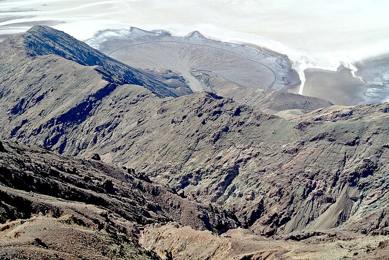
Alluvial fans form where confined, high-gradient streams emerge from mountain fronts onto unconfined, lower-gradient plains. The abrupt decrease in confinement and slope causes a rapid reduction in transport capacity, forcing the deposition of coarse sediment in a semi-conical body that radiates outward from the canyon mouth. Fan surfaces are characterised by distributary channels that shift laterally through a process called avulsion, building the fan surface sequentially. Alluvial fans are particularly prominent features of arid and semi-arid landscapes such as Death Valley and the basin-and-range province of the western United States.7, 10
Deltas form where rivers enter standing bodies of water (oceans, lakes, or reservoirs) and deposit their remaining sediment load. The morphology of a delta reflects the relative importance of river processes (producing elongate, bird-foot deltas such as the Mississippi), wave processes (producing smooth, arcuate deltas such as the Nile), and tidal processes (producing funnel-shaped, tide-dominated deltas such as the Ganges-Brahmaputra).18, 7 Deltas are geomorphically dynamic, with active distributary channels building new land while abandoned lobes subside and erode. The Mississippi Delta, for example, has shifted its primary depocenter at least six times over the past 7,000 years through major avulsion events.18
Drainage networks and basin morphology

Rivers do not exist in isolation but are organised into hierarchical drainage networks that collect water and sediment from entire landscapes. The geometry of these networks was first quantified by Robert Horton in 1945 and refined by Arthur Strahler in the 1950s, who devised the stream-ordering system still widely used today: a first-order stream has no tributaries, two first-order streams joining form a second-order stream, two second-order streams joining form a third-order stream, and so on.10 Strahler showed that the number, length, and drainage area of streams of successive orders follow consistent geometric ratios (Horton's laws of drainage composition), with a typical bifurcation ratio of 3–5, meaning that each order has roughly three to five times as many streams as the next higher order.10, 4
Drainage patterns — the spatial arrangement of channels within a basin — reflect the underlying geology and structure. Dendritic patterns (tree-like branching) develop on horizontally bedded or homogeneous rocks. Trellis patterns, with main channels following structural valleys and short tributaries entering at right angles, are characteristic of folded sedimentary terrain such as the Ridge-and-Valley Province of the Appalachians. Rectangular patterns follow joint and fault systems, while radial patterns drain outward from topographic highs such as volcanoes or structural domes.7, 10
The shape and gradient of a river's long profile — the longitudinal plot of elevation against distance from source to mouth — integrates the effects of tectonics, lithology, climate, and base level. Most rivers exhibit a concave-up profile, with steep gradients near the headwaters and progressively decreasing slopes toward the mouth, a form that reflects the downstream increase in discharge and the consequent reduction in slope needed to transport the sediment load supplied from upstream.4, 6, 17 Departures from the smooth concave profile — knickpoints, convexities, and anomalous reaches — indicate local controls such as resistant rock outcrops, active faults, or tributary junctions that alter the sediment or water budget.10
Human impacts on fluvial systems
Human activities have profoundly altered fluvial systems at every scale, from headwater streams to continental-scale drainage basins. Agriculture is the single largest driver of accelerated erosion: the conversion of forests and grasslands to cropland exposes soil to raindrop impact and sheet wash, increasing sediment yields by an estimated factor of three to eight globally, with local increases exceeding tenfold in severely degraded landscapes.11, 12, 9 Syvitski et al. (2005) estimated that human activities have increased the global flux of sediment from land to rivers to approximately 2.3 ± 0.6 billion tonnes per year above pre-human levels, but simultaneously trapped roughly 1.4 billion tonnes per year behind large dams, so the net flux reaching the ocean has actually decreased by about 1.4 billion tonnes per year compared to pre-dam conditions.9
Dam construction has transformed the hydrology and geomorphology of rivers worldwide. By 2003, more than 45,000 large dams (over 15 metres high) had been registered globally, collectively trapping an estimated 25–30 percent of the global sediment flux behind their reservoirs.14 Downstream of dams, the release of sediment-starved water triggers channel incision, coarsening of the bed surface (armouring), and narrowing of the active channel, while the reduction of flood peaks eliminates the overbank flows that build and maintain floodplains. The ecological consequences — loss of spawning habitat for salmonids, disconnection of rivers from their floodplains, and simplification of channel morphology — have made dam removal an increasingly common river restoration strategy in North America and Europe.7, 14
Channel engineering — including straightening, levee construction, bank armouring, and gravel mining — further modifies fluvial processes. Straightening a channel increases its slope and therefore its stream power, often causing incision and bank erosion both upstream and downstream of the engineered reach. Levees disconnect the river from its floodplain, preventing lateral accretion and floodplain sedimentation, while channelling more water and sediment downstream to amplify flood peaks in unprotected reaches.7, 6 In-stream gravel mining removes the coarse sediment that armours the bed, often leading to dramatic incision and undermining of bridges and other infrastructure.4
Global sediment budget: human impact on land-to-ocean sediment flux9, 14
The fluvial record in deep time
Fluvial deposits are among the most common sedimentary facies in the geological record, preserved wherever subsidence rates were sufficient to accommodate accumulating sediment. Ancient river deposits are recognised by their characteristic stratigraphic architecture: fining-upward successions of channel-fill sandstones and conglomerates overlain by overbank mudstones, with internal cross-bedding recording the migration of bars and dunes across the channel floor.18 The channel-belt sandstones form the reservoir bodies in many of the world's major hydrocarbon provinces, including the Mesaverde Group of the Rocky Mountains, the Permian Red Beds of the Midland Basin, and the Tertiary Molasse of the Alpine foreland.18
The style of fluvial sedimentation has changed through Earth history in response to biological evolution. Before the appearance of land plants in the Silurian and Devonian periods (approximately 470–360 million years ago), the absence of root-stabilised banks meant that nearly all rivers were broad, shallow, and braided, producing laterally extensive sheet sandstones with minimal preservation of fine-grained overbank deposits.18, 10 The colonisation of floodplains by vascular plants introduced cohesion to bank sediments, enabling the development of stable, single-thread meandering channels and the preservation of thick overbank mudstones — a fundamental shift in fluvial style that is clearly recorded in the stratigraphic transition from Silurian braided-stream facies to Carboniferous meandering-river facies in many sedimentary basins worldwide.18
Fluvial deposits also provide archives of past climatic and tectonic conditions. The grain size and mineralogy of channel sands record source-area lithology and relief; the thickness and lateral extent of overbank deposits reflect floodplain width and flooding frequency; and the ratio of channel to overbank facies preserves information about accommodation space and subsidence rate.18, 6 Geochemical proxies extracted from fluvial muds and palaeosols — including carbon isotopes, clay mineralogy, and major-element ratios — have been used to reconstruct palaeoprecipitation, palaeotemperature, and atmospheric CO2 levels across deep time, linking fluvial geomorphology to the broader Earth system.20, 21
References
Geomorphic/tectonic control of sediment discharge to the ocean: The importance of small mountainous rivers
Anthropogenic sediment retention: major global impact from registered river impoundments
Predicting the terrestrial flux of sediment to the global ocean: a planetary perspective
Global silicate weathering and CO₂ consumption rates deduced from the chemistry of large rivers