Overview
- Earthquakes generate two types of body waves -- compressional P-waves and shear S-waves -- whose velocities, reflections, and refractions as they travel through the planet reveal a layered interior of crust, mantle, liquid outer core, and solid inner core.
- Three landmark discoveries in seismology -- the Mohorovicic discontinuity (1909), the Gutenberg core-mantle boundary (1913), and Lehmann's solid inner core (1936) -- were each made by analyzing how seismic waves bend, slow, or vanish at depth boundaries.
- Modern seismic tomography uses millions of recorded wave arrivals to construct three-dimensional maps of Earth's interior, imaging subducted slabs, mantle plumes, and lateral velocity variations with resolution that continues to improve through techniques such as ambient noise correlation and full-waveform inversion.
Seismology is the primary tool through which scientists have determined the internal structure of the Earth. Because no borehole has penetrated deeper than about 12 kilometres — the Kola Superdeep Borehole in Russia — virtually everything known about the composition and physical state of the planet's interior derives from the analysis of seismic waves generated by earthquakes and artificial sources.2 These elastic waves travel through the Earth at velocities that depend on the density and elastic properties of the materials they encounter, and they reflect, refract, and diffract at boundaries where those properties change abruptly. By recording seismic waves at stations distributed around the globe and analysing their arrival times, amplitudes, and waveforms, seismologists have constructed a remarkably detailed picture of Earth's concentric layers: the thin crust, the thick silicate mantle, the liquid iron-nickel outer core, and the solid inner core.2, 4
The history of seismological discovery is one of progressively deeper resolution. Richard Dixon Oldham first demonstrated the existence of a distinct core in 1906.1 Andrija Mohorovičić identified the crust-mantle boundary in 1909. Beno Gutenberg located the core-mantle boundary at approximately 2,900 kilometres depth in 1913. And Inge Lehmann proposed a solid inner core in 1936.6 Each of these discoveries was made by observing anomalies in the behaviour of seismic waves — unexpected arrivals, missing arrivals, or abrupt velocity changes — and inferring the physical properties responsible. Today, seismic tomography extends this approach into three dimensions, using millions of recorded waveforms to image lateral variations in velocity that reveal mantle plumes, subducted slabs, and the fine structure of the deep Earth.7, 8
Types of seismic waves
Earthquakes and other seismic sources radiate energy as elastic waves that fall into two broad categories: body waves, which travel through Earth's interior, and surface waves, which propagate along or near the free surface. Each type carries distinct information about the medium through which it passes.2, 3
P-waves (primary waves) are longitudinal compressional waves in which particle motion is parallel to the direction of wave propagation, analogous to sound waves in air. They are the fastest seismic waves and therefore the first to arrive at a recording station. P-waves travel through solids, liquids, and gases because all three states of matter resist changes in volume. In the upper mantle, P-wave velocities are approximately 8 km/s, increasing to roughly 13.7 km/s at the base of the mantle before dropping sharply to about 8.1 km/s upon entering the liquid outer core, then rising again to approximately 11.3 km/s in the solid inner core.2, 4
S-waves (secondary waves) are transverse shear waves in which particle motion is perpendicular to the direction of propagation. They travel more slowly than P-waves — typically at about 60 percent of the P-wave velocity in the same material — and critically, they cannot propagate through liquids or gases, because fluids do not support shear stress. This property proved decisive in establishing that Earth's outer core is liquid: S-waves generated by earthquakes on one side of the planet are completely absent at stations beyond a certain angular distance on the opposite side, blocked by the molten iron-nickel layer.1, 2 In the upper mantle, S-wave velocities are approximately 4.5 km/s, reaching about 7.3 km/s at the base of the mantle.4
Love waves, named after the British mathematician A. E. H. Love who predicted them in 1911, are surface waves with horizontal shear motion perpendicular to the direction of propagation. They require a velocity increase with depth (a wave guide) to exist and are typically the fastest surface waves. Rayleigh waves, predicted by Lord Rayleigh in 1885, produce an elliptical retrograde particle motion in the vertical plane containing the propagation direction, somewhat like ocean waves. Both types of surface waves are dispersive: their velocity depends on their period, with longer-period waves sampling deeper structure. This dispersion property makes surface waves powerful tools for determining how shear-wave velocity varies with depth in the crust and upper mantle.2, 3
Wave propagation through the Earth
Seismic waves do not travel in straight lines through the Earth. Because seismic velocity generally increases with depth in the mantle, rays are gradually bent (refracted) back toward the surface according to Snell's law, producing curved ray paths. At sharp boundaries where material properties change abruptly — such as the crust-mantle boundary or the core-mantle boundary — waves are both reflected and refracted, generating new phases that arrive at the surface at characteristic times and distances from the earthquake source.2, 3
The velocity at which seismic waves travel depends on two elastic moduli and the density of the medium. For P-waves, velocity is determined by the bulk modulus (resistance to compression) and the shear modulus (resistance to shearing), both divided by density. For S-waves, velocity depends only on the shear modulus and density. Because liquids have zero shear modulus, S-wave velocity drops to zero in the liquid outer core, while P-wave velocity is reduced but remains finite.2, 4 The ratio of P-wave to S-wave velocity (Vp/Vs) is a diagnostic quantity: in typical crustal rocks it is approximately 1.73 (corresponding to a Poisson's ratio of 0.25), but it increases dramatically in partially molten or fluid-saturated regions.3
When a seismic wave encounters a boundary at an oblique angle, part of the energy is reflected and part is transmitted (refracted), with the angles governed by Snell's law. At certain critical angles, total internal reflection occurs and the wave travels along the boundary as a head wave, radiating energy back into the slower medium. This phenomenon explains how the first seismic phases to arrive at regional distances (the Pn and Sn phases) travel along the top of the mantle just below the Moho, arriving ahead of the direct crustal phases despite following a longer geometric path.2, 5
Discovery of major internal boundaries
The recognition that Earth possesses a layered internal structure emerged from a sequence of discoveries spanning the first four decades of the twentieth century, each driven by the careful analysis of anomalies in seismic wave travel times.

In 1906, the Irish-born geologist Richard Dixon Oldham published a landmark analysis of seismic records from several large earthquakes, demonstrating that the travel times of P-waves at large epicentral distances were systematically delayed relative to what would be expected from a homogeneous Earth. He attributed this delay to the presence of a dense central core with markedly different elastic properties from the surrounding mantle. Oldham's paper in the Quarterly Journal of the Geological Society of London was the first convincing evidence that Earth possesses a distinct core, although his estimate of its size was imprecise.1
Three years later, in 1909, the Croatian seismologist Andrija Mohorovičić analysed seismograms from the Kupa Valley earthquake near Zagreb and observed two distinct sets of P-wave and S-wave arrivals. The earlier-arriving set had travelled through a deeper, faster layer, while the later set had travelled entirely within the shallower crust. From the velocity difference, Mohorovičić inferred a sharp boundary separating the crust from the underlying mantle at a depth of approximately 54 kilometres beneath the Balkans. This boundary, now called the Mohorovičić discontinuity (or Moho), varies in depth from about 5 to 10 kilometres beneath the oceans to 30 to 70 kilometres beneath the continents, and it remains one of the best-characterized internal boundaries on Earth.2, 4
In 1913, the German-American seismologist Beno Gutenberg analysed global earthquake records at the Göttingen observatory and identified a sharp decrease in P-wave velocity at a depth of approximately 2,900 kilometres. He observed that beyond an angular distance of about 103 degrees from an earthquake epicentre, direct P-wave arrivals disappeared from seismograms, only to reappear at about 143 degrees with a conspicuous delay. This P-wave shadow zone, combined with the complete absence of direct S-waves beyond 103 degrees, demonstrated that Earth possesses a liquid outer core that refracts P-waves and blocks S-waves entirely. The boundary at 2,900 kilometres depth is now known as the Gutenberg discontinuity or the core-mantle boundary (CMB).2, 4
The final major boundary was identified in 1936 by the Danish seismologist Inge Lehmann. Studying seismograms from large earthquakes recorded in Europe, she noticed that weak P-wave arrivals appeared within the shadow zone where they were not expected if the core were uniformly liquid. In her elegantly titled paper "P′", Lehmann proposed that these anomalous arrivals could be explained by a solid inner core nested within the liquid outer core, from which P-waves could reflect or refract back into the mantle. Her model was adopted by other leading seismologists, including Gutenberg, Harold Jeffreys, and Charles Richter, within a few years, and was confirmed computationally in 1971.6 The inner core boundary (ICB) lies at a depth of approximately 5,150 kilometres, giving the solid inner core a radius of about 1,220 kilometres.4
Shadow zones and what they reveal
Shadow zones are angular ranges on Earth's surface where seismic body waves from a given earthquake fail to arrive or arrive only weakly. Their geometry provides some of the most direct evidence for the size and physical state of the core.2
The P-wave shadow zone extends from approximately 103 to 143 degrees of angular distance from the earthquake epicentre. Within this zone, no direct P-wave arrivals are observed because waves that enter the liquid outer core are refracted sharply downward (the core has a lower P-wave velocity than the lowermost mantle), and the bent rays do not reach the surface in this distance range. Beyond 143 degrees, P-waves that have traversed the core re-emerge and are recorded as the PKP phase. The sharpness of the shadow zone boundaries constrains the radius of the outer core to within a few kilometres of the value established by the PREM model (approximately 3,480 kilometres).2, 4
The S-wave shadow zone is far more extensive: no direct S-waves are observed beyond approximately 103 degrees from the source. Because S-waves cannot propagate through liquid, the entire region of the Earth's surface beyond 103 degrees from any earthquake is an S-wave shadow zone for that event. This observation constitutes the most compelling evidence that the outer core is in a liquid state.1, 2 However, seismological studies using waves that convert between P and S at the inner core boundary have confirmed that S-waves can travel through the solid inner core, appearing as the PKJKP phase — one of the most elusive seismic arrivals to detect because of its extremely low amplitude.4
The weak P-wave arrivals that Lehmann observed within the nominal shadow zone are explained by the inner core: P-waves entering the core can reflect off or refract through the solid inner core (producing phases designated PKiKP and PKIKP, respectively), and these arrivals fill in parts of the shadow zone at reduced amplitudes. The travel times of these inner-core phases constrain the radius and velocity structure of the inner core with high precision.4, 6
Seismic velocity reference models
A reference Earth model describes the average radial variation of seismic velocities, density, and attenuation throughout the planet. Such models provide the baseline against which lateral (three-dimensional) variations are measured and are essential for earthquake location, waveform modelling, and tomographic imaging.4, 5
The most widely used reference model is the Preliminary Reference Earth Model (PREM), published by Adam Dziewonski and Don Anderson in 1981. PREM was constructed by inverting a large dataset comprising approximately 1,000 normal-mode periods, 500 summary travel-time observations, and 100 normal-mode attenuation values, together with the Earth's total mass and moment of inertia. The resulting model specifies P-wave velocity, S-wave velocity, density, and quality factor (Q) as continuous functions of depth from the surface to the centre of the Earth. PREM introduced the important concept of transverse isotropy (different horizontal and vertical velocities) in the uppermost mantle and incorporated the frequency dependence of velocities arising from anelastic dispersion.4
Seismic velocities and density by depth in the PREM model4
| Layer | Depth range | P-wave velocity | S-wave velocity | Density |
|---|---|---|---|---|
| Upper crust | 0–15 km | 5.8 km/s | 3.2 km/s | 2.6 g/cm³ |
| Lower crust | 15–24 km | 6.8 km/s | 3.9 km/s | 2.9 g/cm³ |
| Uppermost mantle | 24–220 km | 8.1 km/s | 4.5 km/s | 3.4 g/cm³ |
| Lower mantle | 670–2,891 km | 10.8–13.7 km/s | 5.9–7.3 km/s | 4.4–5.6 g/cm³ |
| Outer core (liquid) | 2,891–5,150 km | 8.1–10.4 km/s | 0 km/s | 9.9–12.2 g/cm³ |
| Inner core (solid) | 5,150–6,371 km | 11.0–11.3 km/s | 3.5–3.7 km/s | 12.8–13.1 g/cm³ |
A decade later, Kennett and Engdahl (1991) published the iasp91 travel-time model, derived by fitting observed travel-time data from the International Seismological Centre catalogue for the period 1964 to 1987. While PREM was optimised for normal-mode and surface-wave data, iasp91 was designed specifically for accurate earthquake location using body-wave travel times. A further refinement, the ak135 model (Kennett, Engdahl, and Buland, 1995), corrected small but systematic residuals in iasp91 for core phases and is now the standard model used by most global earthquake-location agencies.5 Earlier generations of travel-time tables, notably the Jeffreys-Bullen tables of 1940, served as the global standard for earthquake location for over five decades and remained in official use by the International Seismological Centre until 1991.20
Seismic tomography
While reference models describe the average Earth, the real planet is heterogeneous. Seismic tomography is the technique of using large numbers of seismic wave observations to construct three-dimensional images of velocity variations within the Earth, analogous to medical CT scanning. The approach was pioneered by Aki and Lee (1976), who used P-wave arrival-time residuals from local earthquakes recorded at a dense array to determine three-dimensional velocity perturbations beneath the array.14 The method was subsequently extended to the global scale by Dziewonski, Woodhouse, and others in the 1980s.7
In a typical body-wave tomography study, the observed travel time of a seismic phase (for example, a P-wave from a distant earthquake) is compared to the time predicted by a reference model. The difference, called a travel-time residual, is attributed to velocity anomalies along the ray path. By assembling millions of such residuals from earthquakes distributed around the globe and recorded at hundreds of stations, seismologists solve a large inverse problem to determine the three-dimensional velocity structure that best explains the observations. Regions where waves arrive faster than predicted are interpreted as having higher-than-average velocity (typically cooler, denser material such as subducted lithosphere), while regions of slow arrival indicate lower-than-average velocity (typically hotter, less dense material such as mantle plumes).7, 8
Surface-wave tomography uses the frequency-dependent (dispersive) velocities of Love and Rayleigh waves to constrain shear-wave velocity structure, particularly in the upper mantle where surface waves have their greatest sensitivity. Modern global models such as S40RTS combine Rayleigh-wave dispersion measurements, teleseismic body-wave travel times, and normal-mode splitting data to produce shear-velocity maps of the entire mantle resolved to spherical harmonic degree 40, corresponding to lateral resolution of roughly 1,000 kilometres.9
Tomographic images have revealed several first-order features of the deep Earth. Beneath regions of active subduction, fast velocity anomalies extending from the surface to the transition zone and, in many cases, into the lower mantle are interpreted as cold, dense subducted oceanic lithosphere. Van der Hilst, Widiyantoro, and Engdahl (1997) used P-wave tomography to trace narrow, high-velocity structures from present-day convergent margins down to the core-mantle boundary, providing compelling evidence for whole-mantle convective circulation.8 Beneath oceanic hotspots such as Hawaii, Iceland, and the Afar region, cylindrical low-velocity anomalies extending from the upper mantle into the lower mantle have been imaged and interpreted as mantle plumes — narrow columns of anomalously hot material rising from the deep mantle.18, 22 Broad low-velocity provinces in the lowermost mantle beneath Africa and the central Pacific, known as large low-shear-velocity provinces (LLSVPs), are among the most prominent features in all tomographic models and may represent thermochemical piles that have persisted for hundreds of millions of years.7, 17
Beneath East Asia, tomographic images reveal an enormous stagnant slab — a sheet of fast-velocity material lying horizontally atop the 660-kilometre discontinuity and extending from beneath Japan westward to central China — associated with the long history of Pacific Plate subduction.19 The behaviour of subducted slabs at the transition zone, whether they penetrate directly into the lower mantle or flatten and stagnate, varies among subduction zones and has major implications for the pattern and vigour of mantle convection.8, 19
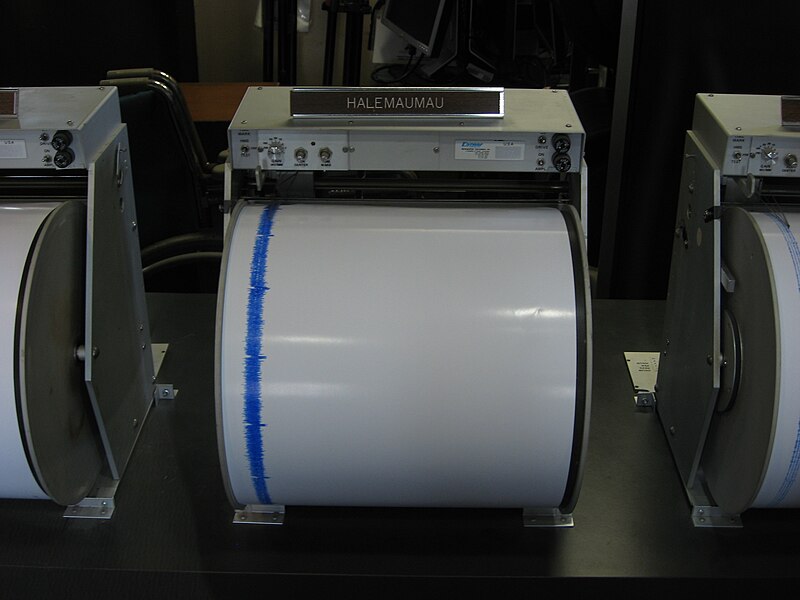
The global seismographic network
The ability to image Earth's interior depends fundamentally on the global distribution of seismometers that record seismic waves. The modern Global Seismographic Network (GSN) consists of approximately 150 permanent broadband stations distributed across all continents and many ocean islands, operated jointly by the United States Geological Survey (USGS) and the National Science Foundation (NSF) through the EarthScope Consortium. The GSN evolved from the World-Wide Standardized Seismograph Network (WWSSN), a system of roughly 120 analogue stations established in the early 1960s partly to monitor nuclear weapons testing under the Limited Test Ban Treaty.15
.jpg)
GSN stations employ triaxial broadband seismometers capable of recording ground motion across the full seismic frequency band, from high-frequency body waves with periods shorter than one second to the Earth's longest free oscillations with periods exceeding one hour. Data are transmitted in near-real time via satellite and the internet, providing open access to the global seismological community. The GSN has enabled advances in earthquake source characterisation, Earth structure determination, and monitoring of non-traditional seismic sources such as glacial calving events, volcanic tremor, and ocean microseisms.15 In addition to the GSN, regional and national networks in seismically active countries operate thousands of additional stations, and temporary deployments such as the USArray Transportable Array (which progressively covered the contiguous United States with approximately 400 stations at 70-kilometre spacing) have provided unprecedented resolution for continental-scale tomographic imaging.11
Earthquake location and magnitude
Locating an earthquake — determining its latitude, longitude, depth, and origin time — is one of the most fundamental tasks in seismology. The standard method exploits the difference in arrival times between P-waves and S-waves. Because P-waves travel faster than S-waves, the time interval between their arrivals at a given station (the S–P time) increases with distance from the source. By reading the S–P time at three or more stations and using established travel-time tables, seismologists triangulate the epicentre — the point on the surface directly above the earthquake focus (hypocentre). Modern location algorithms use iterative least-squares inversion of arrival times from many stations simultaneously, often with three-dimensional velocity models, to determine the four unknowns (latitude, longitude, depth, and origin time) with uncertainties of a few kilometres for well-recorded events.2, 5
The size of an earthquake is quantified by its magnitude, a concept introduced by Charles Richter in 1935. Richter defined the local magnitude (ML) as the base-10 logarithm of the maximum amplitude recorded on a standard Wood-Anderson seismograph at a distance of 100 kilometres from the epicentre, with empirical corrections for other distances.21 The logarithmic scale means that each whole-number increase in magnitude corresponds to a tenfold increase in recorded amplitude and approximately a 31.6-fold increase in energy release. While Richter's scale served well for local earthquakes in southern California, it saturates for very large events (above about magnitude 7) because the short-period waves it measures do not fully represent the total energy radiated by a great earthquake.2
To overcome this limitation, Hanks and Kanamori (1979) introduced the moment magnitude scale (Mw), defined by the relation Mw = (2/3) log10(M0) – 10.7, where M0 is the seismic moment in dyne-centimetres. The seismic moment is a physically based measure of earthquake size that depends on the rigidity of the faulted rock, the area of the fault that ruptured, and the average displacement across the fault. Unlike the Richter scale, the moment magnitude scale does not saturate for the largest earthquakes and provides a consistent measure of size across the full range of magnitudes. It is now the standard scale used by all major seismological agencies for reporting earthquake size.10
Free oscillations and normal modes
When an extremely large earthquake occurs, the entire Earth vibrates as a resonant body, much as a bell rings when struck. These whole-Earth vibrations, called free oscillations or normal modes, were first unambiguously observed following the great Chilean earthquake of 22 May 1960 (Mw 9.5), the largest earthquake in the instrumental record. Benioff, Press, and Smith (1961) identified the spectral peaks corresponding to normal modes in strainmeter and gravimeter records at stations around the world, confirming theoretical predictions that had been made decades earlier.12
Normal modes are standing-wave patterns characterised by spherical harmonic order and divided into two families: spheroidal modes (involving radial and lateral displacements, analogous to the motion of a breathing sphere) and toroidal modes (involving only horizontal shear displacements with no radial component). The fundamental spheroidal mode, 0S2, has a period of approximately 54 minutes; higher-order modes have progressively shorter periods. The frequencies of normal modes depend on the radial distribution of density, elastic moduli, and attenuation throughout the entire Earth, making them uniquely sensitive to the deepest interior including the inner core.4, 12
Normal-mode data played a central role in the construction of PREM. Dziewonski and Anderson (1981) used approximately 1,000 measured mode frequencies to constrain the radial velocity and density structure at depths that body-wave travel times alone cannot resolve with comparable precision, particularly in the lower mantle and core.4 In more recent decades, the analysis of mode splitting — small departures of observed frequencies from the predictions of a spherically symmetric model, caused by Earth's rotation, ellipticity, and lateral heterogeneity — has provided independent constraints on three-dimensional mantle structure that complement and validate body-wave and surface-wave tomographic models.9
Modern imaging techniques
The twenty-first century has brought several methodological advances that substantially expand the resolving power of seismic imaging.

Receiver functions exploit the conversion of P-waves to S-waves (and vice versa) at velocity discontinuities beneath a seismograph station. When a teleseismic P-wave impinges on a sharp boundary such as the Moho, part of its energy converts to an S-wave (called a P-to-S or Ps conversion) that arrives at the station shortly after the direct P-wave. By deconvolving the vertical component of the seismogram from the radial component, a technique formalised by Langston (1979), one obtains the receiver function — a time series whose pulses correspond to the depths and impedance contrasts of subsurface boundaries. Receiver functions have become one of the standard tools for mapping Moho depth and lithospheric structure beneath individual stations or dense arrays.13
Ambient noise tomography represents a paradigm shift in seismological imaging. Rather than relying on earthquakes as sources, this technique extracts empirical Green's functions (the impulse response of the Earth between two stations) from the cross-correlation of long records of ambient seismic noise — the continuous low-level ground vibration generated primarily by ocean waves interacting with the seafloor. Shapiro, Campillo, Stehly, and Ritzwoller (2005) demonstrated that cross-correlating one month of ambient noise data from USArray stations in California yielded high-resolution surface-wave group-velocity maps at periods of 7.5 to 15 seconds, revealing sedimentary basins and igneous mountain cores with striking clarity.11 The advantage of the method is that it produces measurements on every pair of stations in a network, regardless of earthquake distribution, dramatically increasing path coverage and resolution in regions far from seismically active plate boundaries.
Full-waveform inversion (FWI) goes beyond measuring only travel times or phase velocities and instead fits the complete recorded seismogram — amplitudes, waveforms, and all seismic phases — using synthetic seismograms computed through three-dimensional numerical models of the Earth. Although computationally expensive, FWI has the potential to resolve structures smaller than a wavelength and to exploit information in waveform complexities (diffractions, multiple scattering, wavefield focusing) that conventional tomography discards. Regional and continental-scale FWI models have revealed new details of lithospheric and upper-mantle structure beneath densely instrumented regions.7, 16
Together, these modern techniques are progressively sharpening the image of Earth's interior. The combination of body-wave tomography, surface-wave tomography, normal-mode constraints, receiver functions, ambient noise correlation, and full-waveform inversion — each sensitive to different aspects of Earth structure and operating at different scales — is converging toward an increasingly detailed and self-consistent picture of the planet from crust to core.7, 9, 17
References
S40RTS: a degree-40 shear-velocity model for the mantle from new Rayleigh wave dispersion, teleseismic traveltime and normal-mode splitting function measurements
Determination of three-dimensional velocity anomalies under a seismic array using first P arrival times from local earthquakes: 1. A homogeneous initial model
New seismic model of the upper mantle beneath the western Pacific from interstation dispersion of surface waves