Overview
- The Indus Valley (Harappan) civilization was one of the three earliest urban societies in the Old World, flourishing across a vast region of South Asia from roughly 3300 to 1300 BCE and reaching its zenith during the Mature Harappan phase (2600–1900 BCE) with highly planned cities, advanced sanitation, and standardized weights and measures.
- Harappan urbanism is distinguished by the apparent absence of monumental royal or religious architecture, a still-undeciphered script, remarkable craft specialization in bead-making and metallurgy, and long-distance trade networks extending to Mesopotamia, the Persian Gulf, and Central Asia.
- The civilization's decline after 1900 BCE involved de-urbanization rather than sudden collapse, driven by a combination of weakening monsoons, shifts in river hydrology including the drying of the Ghaggar-Hakra system, and social reorganization that dispersed populations into smaller, rural settlements.
The Indus Valley civilization, also known as the Harappan civilization, was one of the earliest urban societies in human history, flourishing across a vast expanse of South Asia from approximately 3300 to 1300 BCE. At its peak during the Mature Harappan phase (roughly 2600 to 1900 BCE), it encompassed an area of over one million square kilometres stretching from northeastern Afghanistan through Pakistan and into northwestern India, making it the largest of the three great Bronze Age civilizations alongside ancient Mesopotamia and Egypt.1, 2 The civilization supported an estimated population of several million people across more than 1,500 known settlements, including the major urban centres of Mohenjo-daro, Harappa, Dholavira, and Rakhigarhi.2, 5
Harappan society is remarkable for what it achieved and equally for what it appears to lack. Its cities exhibit sophisticated urban planning, advanced hydraulic engineering, standardized weights and measures, and long-distance trade reaching as far as the Persian Gulf and Mesopotamia. Yet there are no obvious palaces, no monumental royal tombs, no triumphal inscriptions, and no clear evidence of a centralized political authority of the kind found in contemporary Egypt or Mesopotamia. The Indus script, attested on thousands of seal impressions and other objects, remains undeciphered, leaving fundamental questions about Harappan governance, religion, and social organization unanswered.1, 8
Discovery and chronology
The existence of the Indus Valley civilization was unknown to modern scholarship until the 1920s, when excavations at Harappa in the Punjab (directed by Daya Ram Sahni) and Mohenjo-daro in Sindh (directed by R. D. Banerji, and later expanded under Sir John Marshall) revealed the remains of large, planned cities dating to the third millennium BCE.3 Marshall's landmark 1931 publication brought the civilization to international attention, establishing it alongside Egypt and Mesopotamia as one of the great cradles of urban life. Since then, more than 1,500 Harappan sites have been identified across Pakistan and India, and major excavations have been conducted at Dholavira in Gujarat, Rakhigarhi in Haryana, Lothal, Kalibangan, and Banawali, among others.2, 7
The chronology of the civilization is conventionally divided into three broad phases, established through archaeological dating methods including radiocarbon analysis and stratigraphic correlation. The Early Harappan or Regionalization Era (roughly 3300 to 2600 BCE) saw the development of village farming communities across the Indus and Ghaggar-Hakra river systems, the emergence of regional ceramic traditions such as Kot Diji, Amri, and Hakra Ware, and the beginnings of craft specialization and inter-regional exchange.18 The Mature Harappan or Integration Era (roughly 2600 to 1900 BCE) represents the period of full urbanization, during which the distinctive features of Harappan culture — standardized brick sizes, the Indus script, uniform weights, and planned urban layouts — appear across the entire geographic range, suggesting a remarkable degree of cultural integration.1, 2 The Late Harappan or Localization Era (roughly 1900 to 1300 BCE) is characterized by the decline and eventual abandonment of the major cities, the fragmentation of the formerly integrated cultural sphere into regional traditions, and a general shift toward smaller, more dispersed settlements.17, 18
Geography and environment
The Harappan civilization occupied one of the most extensive geographic zones of any Bronze Age society. Its settlements spanned from Shortugai on the Oxus River in northeastern Afghanistan to Daimabad in Maharashtra, and from Sutkagen Dor on the Makran coast of Balochistan to Alamgirpur in Uttar Pradesh.2, 4 The core of the civilization lay along two major river systems: the Indus and its tributaries in the west, and the now-dry Ghaggar-Hakra system in the east, which once flowed through Rajasthan and into the Rann of Kutch. The concentration of settlements along these watercourses reflects the dependence of Harappan agriculture on riverine floodplains and the seasonal monsoon, which together sustained the domestication of plants and animals that underpinned urban life.13, 14
The landscapes inhabited by Harappan communities ranged from the arid coasts of Gujarat and Makran to the well-watered alluvial plains of the Punjab and Sindh, and from the highland valleys of Balochistan to the semi-arid margins of the Thar Desert. This environmental diversity shaped regional subsistence strategies: sites in the western Indus valley relied primarily on wheat and barley cultivation irrigated by river flooding, while communities in Gujarat adapted to drier conditions by constructing water storage reservoirs and diversifying into pastoral herding of zebu cattle, water buffalo, sheep, and goats.21, 22 Geomorphological research has demonstrated that the Ghaggar-Hakra system was not a large perennial river fed by Himalayan glaciers, as once believed, but rather a monsoon-fed seasonal watercourse whose major tributaries had already shifted eastward into the Yamuna-Ganges system before the Mature Harappan period began.14
Major sites
Mohenjo-daro, located in the Larkana District of Sindh, Pakistan, is the best-known Harappan city and a UNESCO World Heritage Site since 1980.23 The site covers approximately 250 hectares and was one of the largest settlements in the ancient world at its peak, with an estimated population of 30,000 to 40,000. The city is divided into an elevated western mound (the so-called Citadel, though it contains no fortifications in the military sense) and a larger, lower eastern mound (the Lower Town), both laid out on a grid pattern with major streets running roughly north-south and east-west. Among the most celebrated structures is the Great Bath, a carefully waterproofed brick tank measuring approximately 12 by 7 metres, which Marshall interpreted as a facility for ritual bathing.3, 1
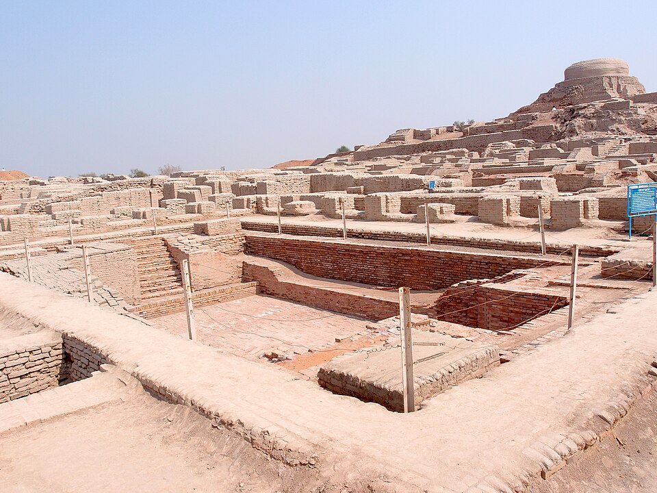
Harappa, located in Punjab, Pakistan, is the type site for the civilization and was extensively excavated from the 1920s onward, though significant portions were destroyed in the nineteenth century when its bricks were used as ballast for the Lahore-Multan railway. The site encompasses multiple walled sectors and reveals a long occupational sequence from the Early Harappan through the Late Harappan period. Excavations by Kenoyer and Meadow from the 1980s onward have provided detailed evidence for craft production, including extensive workshops for bead-making, shell-working, and copper-alloy metallurgy.1, 19
Dholavira, situated on Khadir Island in the Rann of Kutch, Gujarat, India, was inscribed as a UNESCO World Heritage Site in 2021.24 The site is notable for its elaborate water management system, consisting of a series of reservoirs carved into the bedrock and connected by channels designed to capture seasonal rainfall and runoff in an arid landscape. Dholavira also features a distinctive tripartite layout with a citadel, middle town, and lower town, as well as a large inscription composed of individual signs crafted from white crystalline material and mounted on a wooden board above one of the city's gates — one of the most striking examples of Harappan sign use yet discovered.7
Rakhigarhi, in Haryana, India, is the largest known Harappan site by area, potentially exceeding 300 hectares across its multiple mounds. Excavations from 2014 onward have revealed Mature Harappan architecture, streets, drains, and craft production areas. DNA recovered from a burial at Rakhigarhi provided the first ancient genome from the Indus Valley civilization, revealing that the individual lacked the Steppe pastoralist ancestry that characterizes later South Asian populations, a finding with significant implications for understanding the population history of the subcontinent.5, 6
Major Harappan sites and their key features1, 2, 7
| Site | Location | Estimated area | Notable features |
|---|---|---|---|
| Mohenjo-daro | Sindh, Pakistan | ~250 ha | Great Bath, granary, grid-plan streets |
| Harappa | Punjab, Pakistan | ~150 ha | Craft workshops, cemetery H, long sequence |
| Dholavira | Gujarat, India | ~100 ha | Rock-cut reservoirs, signboard inscription |
| Rakhigarhi | Haryana, India | ~300+ ha | Largest site, ancient DNA recovery |
| Lothal | Gujarat, India | ~5 ha | Possible dockyard, bead factory |
| Kalibangan | Rajasthan, India | ~12 ha | Ploughed field, fire altars |
Urban planning and sanitation
The most immediately striking feature of Mature Harappan cities is their degree of urban planning. Streets were laid out on an approximately orthogonal grid, with major thoroughfares running roughly cardinal directions and narrower lanes branching off at right angles. Residential blocks were composed of houses built from standardized baked and sun-dried bricks in a consistent ratio of 1:2:4 (thickness to width to length), a proportion maintained across sites separated by hundreds of kilometres.1, 2 This remarkable standardization has been interpreted as evidence for some form of coordinated planning authority, though its precise nature remains debated.
Harappan cities possessed what was arguably the most advanced sanitation infrastructure in the ancient world. Individual houses had private bathing platforms and latrines connected by brick-lined drains to covered sewers running beneath the streets. These drains were equipped with sump pits at intervals to collect sediment, and manholes or removable brick covers allowed periodic cleaning.1, 3 The investment in water management extended beyond waste removal: at Dholavira, an elaborate system of rock-cut reservoirs and channels captured and stored rainwater, while at Mohenjo-daro, numerous wells throughout the city provided fresh water to residents.7, 3 No comparable urban drainage system existed anywhere else in the Bronze Age world, and the Harappan emphasis on water management — both supply and disposal — suggests that concerns about cleanliness or ritual purity may have played a significant role in civic life.
Weights, measures, and the Indus script
The Harappan weight system was based on a binary-decimal progression. The basic unit, a cubical chert weight of approximately 13.7 grams, was multiplied by factors of 2, 4, 8, 16, 32, 64 for the lower denominations and by factors of 10 and its multiples for the larger denominations. This system was remarkably consistent across the entire geographic range of the civilization, with weights from Mohenjo-daro, Harappa, Lothal, and other sites conforming to the same standard.20, 1 Linear measurement was similarly standardized; rulers recovered from Mohenjo-daro and Lothal indicate a unit of approximately 1.32 millimetres, with larger divisions corresponding to "Indus inches" and "Indus feet."1
The Indus script is attested on more than 4,000 objects, predominantly steatite seals and their clay impressions, but also on pottery, copper tablets, and other media. The inscriptions are short, averaging fewer than five signs per text, with the longest known inscription containing only 26 signs.8, 9 Approximately 400 to 450 distinct signs have been identified, a number too large for an alphabet but consistent with a logo-syllabic writing system in which some signs represent words and others represent syllables. Statistical analyses of the sign sequences have demonstrated that the script exhibits an entropy consistent with natural language rather than non-linguistic symbol systems, though this finding has been debated.10 The question of whether the Indus script represents true writing in the sense of encoding a spoken language places it at the centre of broader debates about the invention of writing and what distinguishes writing systems from proto-writing or purely symbolic notation.
Despite more than a century of attempts, the Indus script remains undeciphered. The brevity of the texts, the absence of any bilingual inscription (no Indus "Rosetta Stone" has been found), and the uncertainty about the underlying language have frustrated all efforts at decipherment. Asko Parpola and others have proposed that the script encodes an early Dravidian language, based on structural parallels and the distribution of Dravidian languages in South India and pockets of Balochistan, but this hypothesis remains unproven.9 The undeciphered script is the single greatest obstacle to understanding Harappan society, as it means that the civilization's own voice — its administrative records, its religious texts, its political declarations, if any such existed — remains silent.
Trade and craft specialization
The Harappan civilization participated in extensive long-distance trade networks that connected South Asia to the broader Bronze Age world. Mesopotamian cuneiform texts from the Akkadian and Ur III periods (roughly 2350 to 2000 BCE) refer to trade with a land called Meluhha, which scholars have identified with the Indus Valley civilization on the basis of the commodities described: carnelian beads, ivory, timber, and other goods characteristic of Harappan production.11 Indus-type seals and Harappan-style artifacts have been found at sites in ancient Mesopotamia, the Persian Gulf (particularly Bahrain and Failaka), and Oman, while Mesopotamian and Gulf materials — including lapis lazuli from Afghanistan, tin from Central Asia, and marine shells from the Arabian coast — have been recovered from Harappan sites.2, 11
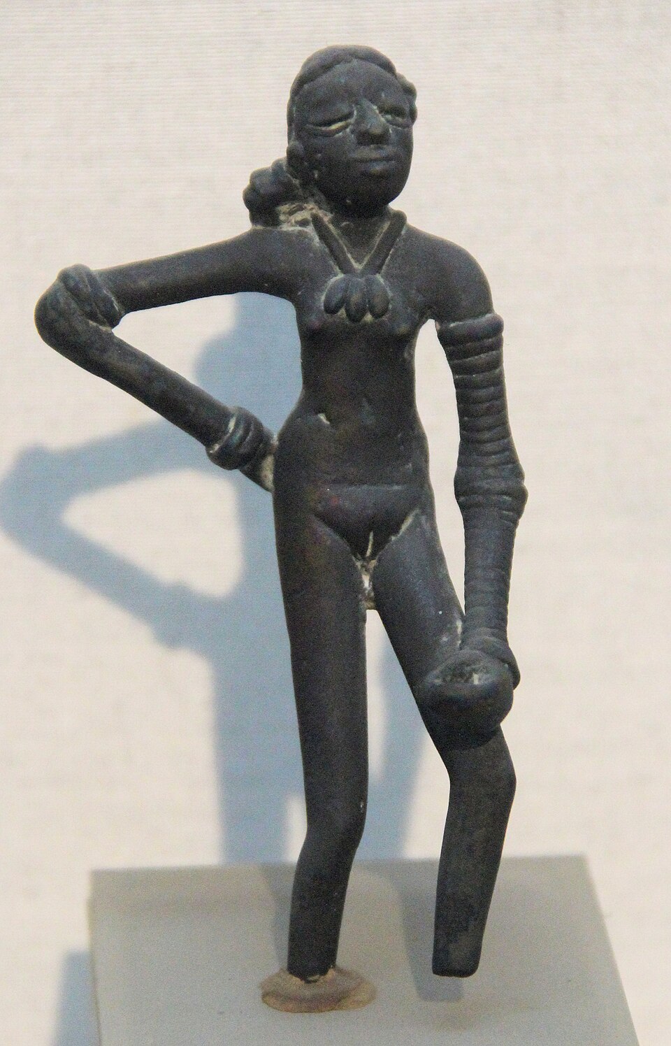
Craft production was highly specialized. At Harappa, distinct quarters of the city were devoted to specific industries. Bead workshops produced long barrel-shaped carnelian beads using a laborious technique involving heating, drilling with copper-tipped drills, and extended polishing. Steatite was carved into the distinctive square seals bearing animal motifs (most commonly a unicorn-like bull) and Indus script inscriptions. Shell-workers fashioned bangles and inlays from conch shells imported from the coast of Gujarat. Copper and bronze objects were produced by lost-wax casting and other techniques, and faience and gold were worked with considerable skill.1, 19 Strontium isotope analyses of human remains from Harappa have demonstrated that at least some individuals were non-local, suggesting that the cities attracted people from different regions, consistent with the economic pull of specialized urban production centres.12
Social organization and the absence of monumental authority
One of the most debated aspects of the Harappan civilization is the nature of its political and social organization. Unlike contemporary Mesopotamia, with its ziggurats, royal palaces, and elaborate royal tombs, and unlike Egypt, with its pyramids and pharaonic monuments, the Indus Valley civilization has yielded no unambiguous evidence for centralized political authority in the form of monumental architecture glorifying rulers or elites.1, 2 There are no depictions of warfare, no triumphal art, and no oversized residences that can be confidently identified as palaces. Burials are relatively modest and largely uniform, lacking the dramatic wealth differentiation seen in royal tombs at Ur or in Egyptian pyramidal complexes.
This absence has prompted a range of interpretations. Some scholars have proposed that Harappan society was governed by a collective or corporate authority — perhaps a council of merchants, priestly elites, or clan leaders — rather than by individual kings. Others have suggested that power was decentralized, with each major city functioning as an autonomous polity loosely connected to the others through shared cultural norms, trade relationships, and perhaps kinship networks.2, 17 The standardization of weights, bricks, and script across the entire civilization does imply some coordinating mechanism, but whether this was political, economic, or ideological in nature cannot be determined from the material evidence alone. Until the Indus script is deciphered, the question of Harappan governance will remain one of the great open problems in archaeology.
Agriculture and subsistence
The Harappan economy rested on a diverse agricultural base adapted to the varied environments of the Indus plains, the Ghaggar-Hakra drainage, and the coastal regions of Gujarat and Makran. The primary crops included wheat and barley, which were winter (rabi) crops suited to the cool season, and millets (both African finger millet and indigenous South Asian varieties), rice, and various pulses, which were summer (kharif) crops grown during the monsoon.21, 22 This dual-season cropping strategy, rooted in the broader history of domestication of plants and animals in South Asia and the Near East, provided a degree of subsistence resilience by spreading risk across two growing seasons with different rainfall requirements.
Isotopic and archaeobotanical evidence from multiple sites has revealed that the balance between winter and summer crops varied across the civilization's geographic range. Sites in the western Indus Valley and Balochistan relied more heavily on wheat and barley, while sites in Gujarat and the eastern margins increasingly cultivated millets and rice, crops better suited to summer rainfall. This pattern suggests that Harappan farmers flexibly adapted their crop choices to local environmental conditions rather than relying on a single imposed agricultural regime.22 Pastoral activities also contributed significantly to subsistence: cattle (both zebu and non-zebu varieties), water buffalo, sheep, and goats were kept, and the zebu bull appears prominently in Harappan iconography, suggesting cultural as well as economic importance.21
Decline and de-urbanization
The Mature Harappan phase ended around 1900 BCE, after which the major cities were progressively abandoned over the following centuries. This process is better characterized as de-urbanization — a dispersal of population into smaller, more numerous rural settlements — rather than as a sudden civilizational collapse. Many Late Harappan sites continue to show Harappan material culture traits, including pottery styles and craft traditions, but without the hallmarks of urban life: the planned grid layouts, the elaborate drainage systems, the standardized weights, and the Indus script all disappear or diminish markedly.17, 18
Multiple factors have been proposed to explain this transformation, and current scholarship favours a multi-causal model. Paleoclimate evidence from lake sediments, speleothems, and marine cores indicates that the Indian summer monsoon weakened significantly around 2100 to 1900 BCE, reducing the rainfall on which much of Harappan agriculture depended.15 Geomorphological studies have demonstrated that the Ghaggar-Hakra river system, along which many Harappan settlements were concentrated, underwent major changes during the third and second millennia BCE. Far from being a large perennial river (sometimes identified with the legendary Sarasvati), the Ghaggar-Hakra appears to have been a monsoon-fed seasonal system that became increasingly unreliable as the monsoon weakened, and whose major Himalayan tributaries had already shifted eastward into the Yamuna-Ganges system before the Mature Harappan period began.13, 14
The interaction between climate change and Harappan settlement patterns was not simply one of decline, however. Recent work by Petrie and colleagues has emphasized the adaptive capacity of Harappan populations, who appear to have shifted their cropping strategies toward summer crops (millets and rice) better suited to reduced but still present monsoon rainfall, and who migrated eastward and southward into regions with more reliable water sources.16 The Late Harappan period thus represents not a catastrophic end but a transformation: the dissolution of the integrated urban system into a patchwork of regional cultures that preserved some Harappan traditions while developing new ones. The causes of the loss of urbanism itself — why cities were abandoned rather than merely adapted — may involve the breakdown of the trade networks, administrative systems, and social institutions that had sustained them, but in the absence of decipherable texts, the internal social dynamics of the transition remain largely opaque.16, 17
Legacy and significance
The Indus Valley civilization occupies a unique position in the study of early complex societies. It demonstrates that large-scale urbanism, standardization, and interregional integration can emerge and persist for centuries without the monumental royal institutions that characterize other early states. Its sanitation infrastructure had no parallel in the ancient world, and its weight system exhibits a precision and geographic consistency that rivals anything produced by its Mesopotamian and Egyptian contemporaries.1, 20 The civilization's trade connections, extending from Central Asia to the Persian Gulf, attest to its economic vitality and its integration into the broader networks of Bronze Age exchange.11
At the same time, the civilization's most profound legacy may be its unanswered questions. The undeciphered script, the ambiguous political structure, and the still-debated causes of de-urbanization make the Harappan civilization one of the most tantalizing subjects in archaeology. Two of its major sites — Mohenjo-daro and Dholavira — are UNESCO World Heritage Sites, and ongoing excavations at Rakhigarhi, Farmana, and other locations continue to refine understanding of this remarkable society.5, 23, 24 Ancient DNA research, isotopic studies of mobility and diet, and high-resolution paleoenvironmental reconstructions are opening new avenues of inquiry that may, in time, illuminate aspects of Harappan life that the undeciphered script has kept hidden.6, 12, 13
References
Isotopic and Archaeobotanical Evidence for Diverse Food Systems in the Indus Civilization